
| Rainier Home | Contact Infomation | Statistics Explained | Map Information | Scope | Current Conditions |
|---|
STATISTICS:
|
Click on map icon to expand
|
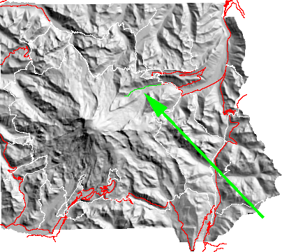
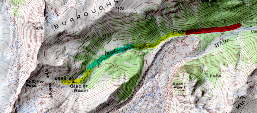
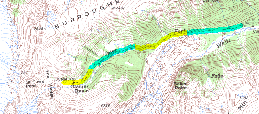
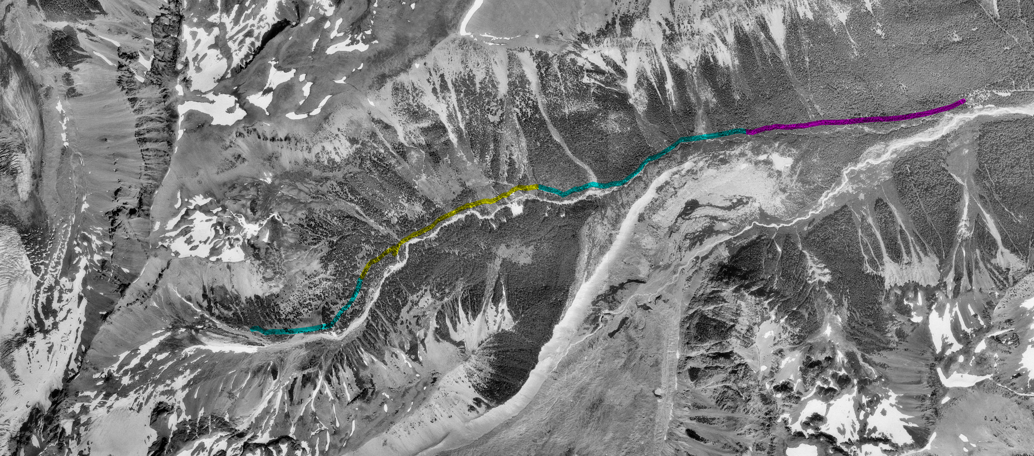
An easy walk from the White River campground. While the hike does not offer overwhelming views of The Mountain it does offer the peaceful calm of a meadowy basin.
| Map Discription | Size (kb) |
| Small colored elevaton map | 9 |
| Topographic map with shadeing | 541 |
| Topographic map without shadeing | 189 |
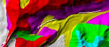
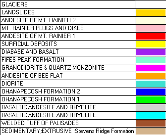
| Shaded Basement Geologic Map | 34 |
| Air Photo | 4,385 |
|
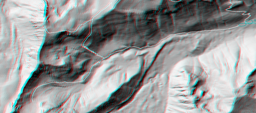
Stereo Map To see this image you will need special glasses (which I will provide if you contact while supplies last) |
369 |
return to main Rainier Trail Index
Gregg Petrie ©2000