
| Rainier Home | Contact Infomation | Statistics Explained | Map Information | Scope | Current Conditions |
|---|
STATISTICS:
|
click on map icon to expand
|
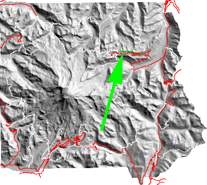
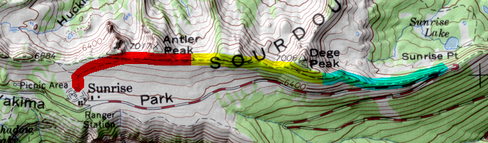
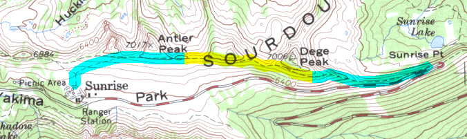
Starting at Sunrise the trail moves east below the Sourdough Mountains that rise above the road to Sunrise. A short side trip is possible to Dege Peak and views of the Sarvent Glaciers, Cowlitz Chimneys, White river, SR 410, the peaks of the Cascades and Olympic Mountains, and Rainier itself. If transportation can be arranged then it is possible to follow the trail down to Sunrise point and then ride back.
While the map shows the hike going from west to east it is arguably better to travel from Sunrise point to Sunrise since the view is always in front of you; at very little cost in elevation gain.
| Map Discription | Size (kb) |
| Small colored elevaton map | 4 |
| Topographic map with shadeing | 255 |
| Topographic map without shadeing | 79 |
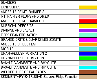
| Shaded Basement Geologic Map | 16 |
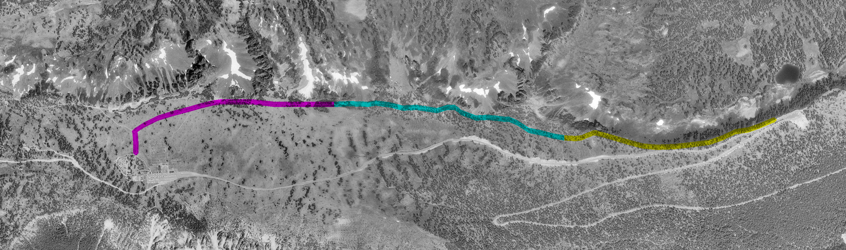
| Air Photo | 1,883 |
|
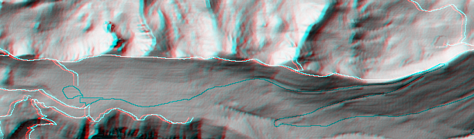
Stereo Map To see this image you will need special glasses (which I will provide if you contact while supplies last) |
177 |
return to main Rainier Trail Index
Gregg Petrie ©2000