
| Rainier Home | Contact Infomation | Statistics Explained | Map Information | Scope | Current Conditions |
|---|
STATISTICS:
|
click on map icon to expand map
|
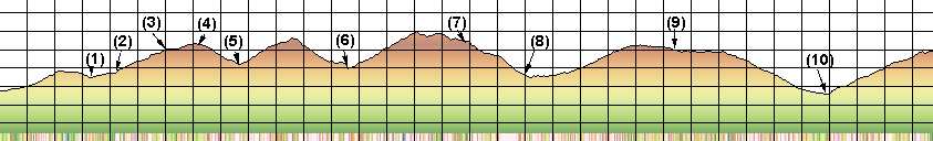
- (1) Kautz Creek Trail junction
- (2) Pyramid Creek Camp
- (3) Devils Dream
- (4) Indean Henrys Hunting Ground
- (5) Suspension bridge
- (6) South Puyallup Camp
- (7) Klapathe Park
- (8) North Puyallup Camp
- (9) Golden Lake camp
- (10) Mowich River Camp
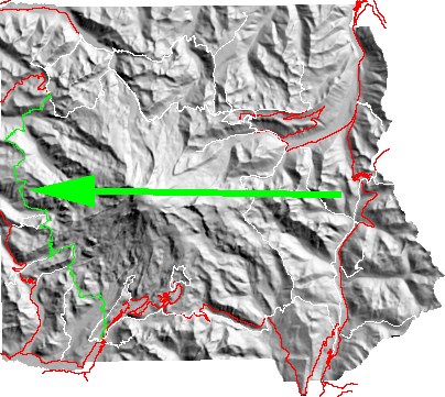
My experience suggests that most hikers travel the Wonderland Trail in a clockwise direction starting at Longmire and traveling north toward Mowich Lake. If this convention is used the first part of the hike is a short climb over Rampart Ridge to Pyramid Creek wilderness camp. From here the next camp is found at only 2 miles at Devils Dream Creek or 8 difficult, but scenic miles, to the South Puyallup River camp. This segment includes the flower fields of Indian Henry's Hunting Ground and the Tahoma Creek suspension bridge. After climbing over Emerald Ridge the trail meets the South Puyallup River wilderness camp. From here the trail climbs steeply to meadowland, skirts St. Andrews Lake and descends to Aurora Lake and arguably the most beautiful wilderness campsites on the trail at Klapatche Park. From here the trail goes back into forest and travels to the North Puyallup River camp. From the river the trail climbs in parkland of the Golden Lakes Camp. From Golden Lakes the trail leaves the meadowland and descends into the woods to the Mowich river wilderness camp and then climbs the last 3.4 miles to Mowich Lake.
For a detailed description the reader is referred to
"Discovering the wonders of the Wonderland Trail: Encircling Mount Rainier" by Bette Filley
| Map Discription | Size (kb) |
| Small colored elevaton map | 4 |
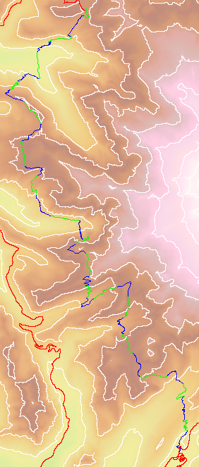
| Topographic map with shadeing | 4,797 |
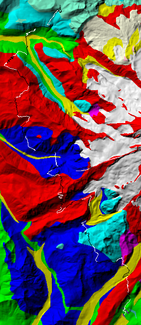
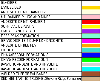
| Shaded Basement Geologic Map | 285 |
|
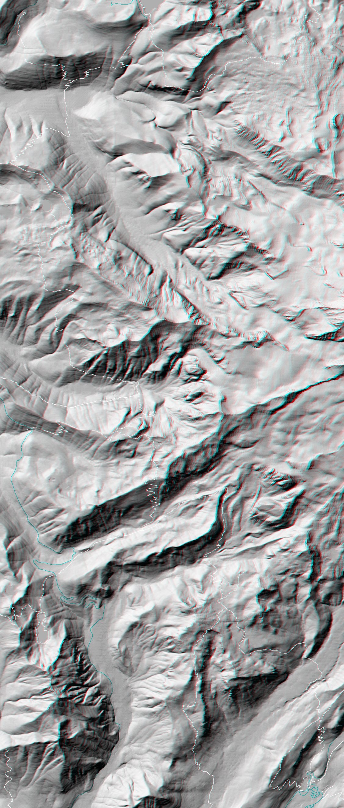
Stereo Map To see this image you will need special glasses (which I will provide if you contact me before supplies run out) |
3,193 |
return to main Rainier Trail Index
Gregg Petrie ©2000