| Apline Lakes:West Home | Contact Infomation | Statistics Explained | Map Information | Scope |
|---|
STATISTICS:
|
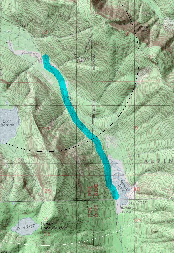
click on map to zoom in for trail location
|
Sunday Lake Trail #1000 Directions: I-90 to exit #31. Turn north toward the town of North Bend. Take a right on North Bend Way and then a left onto Ballarat Street. After about 4.0 miles, follow the "Y" in the road to the left, putting one onto the North Fork County Road (#57). Continue approximately 14.5 miles to Road #5720 and a Weyerhaeuser gate. Park on the left side of the road. Walk through the gate to the first road junction, stay right and at the second junction (1.5 miles), stay left. This old road crosses Sunday Creek in 0.25 mile. The road bridge has collapsed and there are several routes a cross the creek. Use caution when crossing the creek. The trail starts on the east side of the creek and continues another 1.6 miles to Sunday Lake 1
Attractions & Considerations: The entire hike to the lake, including the road, is 3.1 miles. It is a moderate, low elevation hike through old growth forest. The trail becomes brushy and difficult to find beyond Sunday Lake. The tread is gone in many places making the trail very rocky. Several large windfalls also block the route. 1
1Source: USFS Trail Guide
return to Alpine West Home Page
Gregg Petrie ©2000