| Apline Lakes:West Home | Contact Infomation | Statistics Explained | Map Information | Scope |
|---|
STATISTICS:
|
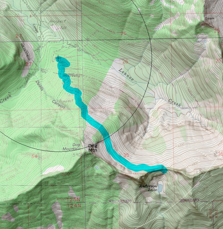
click on map to zoom in for trail location
|

Lennox Creek Trail #1001 Directions: I-90 to exit #31. Turn north toward the town of North Bend. Take a right on North Bend Way and then a left onto Ballarat Street. After about 4.0 miles, follow the "Y" in the road to the left, putting one onto the North Fork County Road (#57). Continue approximately 16.5 miles to a junction, where Road #57 turns left and crosses the river. At the next junction, stay to the right and continue another 4.5 miles to the Bare Mountain trailhead; park here. From this point the road is washed out and must be traveled by foot. 1
Attractions & Considerations: The trail follows the old road for approximately 2.0 miles at which point it enters into the Alpine Lakes Wilderness area. The hike continues through old growth timber for 2.0 miles, until reaching the tree line of Dog Mountain. The last mile contours across sub-alpine meadows and slabs of granite. The maintained trail ends upon reaching the saddle, and hikers are rewarded with views to the north, east and south to Mt. Rainier. From the saddle, it is a quick scramble to either Anderson Lake or up the ridge to Dog Mountain. 1
1Source: USFS Trail Guide
return to Alpine West Home Page
Gregg Petrie ©2000