| Apline Lakes:West Home | Contact Infomation | Statistics Explained | Map Information | Scope |
|---|
STATISTICS:
|
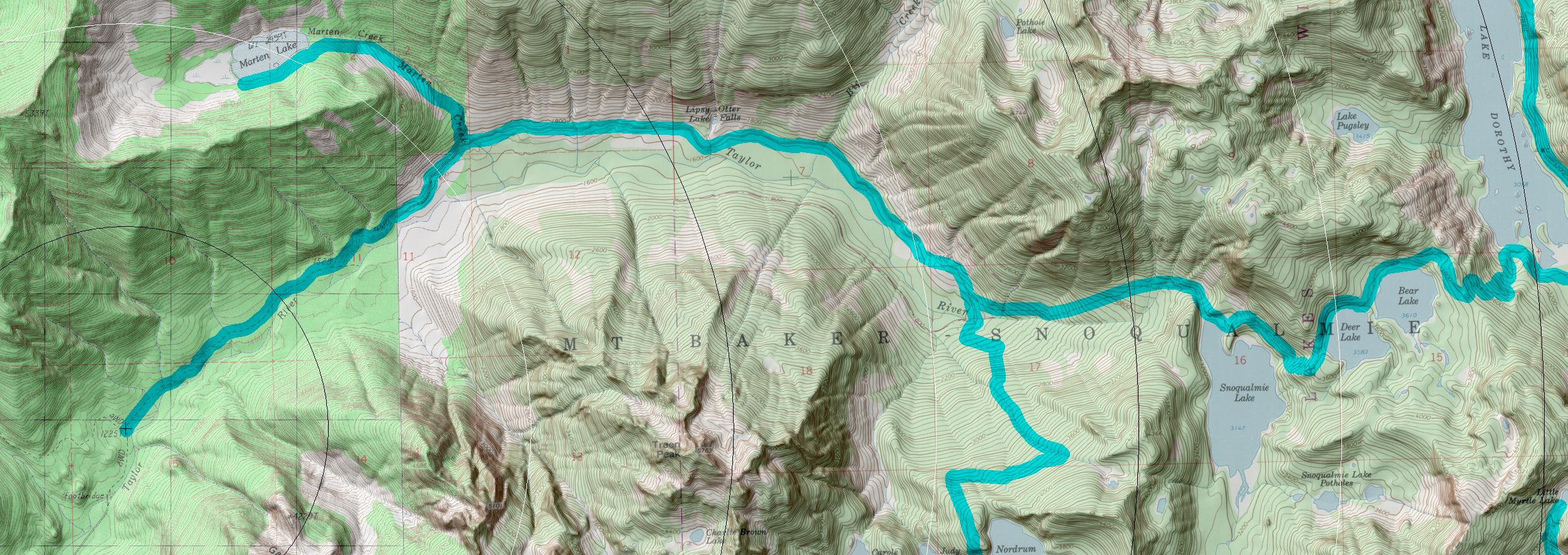
click on map to zoom in for trail location
|

Snoqualmie Lake Trail #1002 Directions: I-90 to exit 34. Turn north on Edgewick Road. In 0.6 mile turn right onto SE Middle Fork Road #56. Stay on Road #56 for 12.2 miles just after the bridge crossing. Continue on the left fork to the Taylor River Road #5620. In another 0.4 mile, park at the gate. The trailhead is beyond the gate, across the Taylor River Bridge. 1
Attractions & Considerations: This trail crosses Marten Creek Bridge, passes numerous waterfalls and climbs through old growth forest before arriving at Snoqualmie Lake, one of the largest in the area. The trail continues for another two miles, climbing to Deer and Bear Lakes. All three lakes offer fishing, swimming, and nice views. You may also make connections with other trails going beyond the district boundary. It is a ten mile hike from the parking lot at the Taylor River to the end of the Snoqualmie Lake Trail above Bear Lake. 1
1Source: USFS Trail Guide
return to Alpine West Home Page
Gregg Petrie ©2000