| Apline Lakes:West Home | Contact Infomation | Statistics Explained | Map Information | Scope |
|---|
STATISTICS:
|
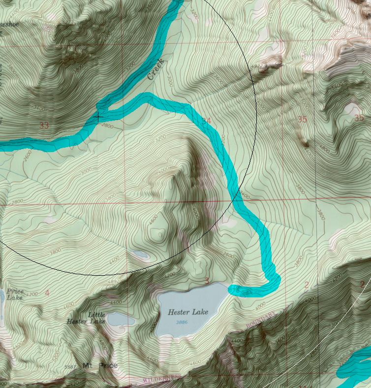
click on map to zoom in for trail location
|

Hester Lake Trail #1005.1 Directions: I-90 to exit #34. Turn north on 468th Avenue. In 0.6 mile turn right onto SE Middle Fork Road #56. Stay on Road #56 for 12.2 miles; turn right to continue on Road #56. In 1.0 mile Road #56 turns left. Continue for approximately 5.0 miles to the Dingford Creek trail head on the left side (parking is on the right side).
Hike the Dingford Creek Trail #1005 for 3.0 miles to the junction, where the Hester Lake Trail goes to the right. .1
Attractions & Considerations: From the junction the trail continues at a gradual grade. It immediately crosses 2 forks of Dingford Creek, a crossing that may require wet feet. Just beyond Dingford Creek the trail may be hard to find due to washouts. The trail climbs gradually for about 2.0 miles then switchbacks to a bench below Mt. Price. Hester Lake sits in this narrow valley. There are several campsites near the lake. 1
1Source: USFS Trail Guide
return to Alpine West Home Page
Gregg Petrie ©2000