| Apline Lakes:West Home | Contact Infomation | Statistics Explained | Map Information | Scope |
|---|
STATISTICS:
|
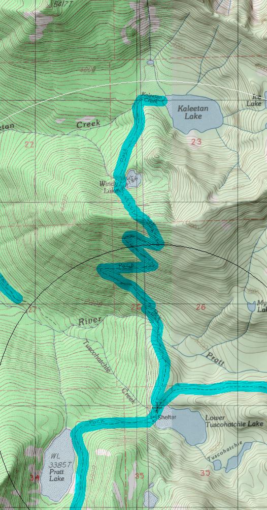
click on map to zoom in for trail location
|

Kaleetan Lake Trail #1010 Directions: Exit #47 from I-90. Turn north from the off-ramp, across the overpass and take a left at the "T" in the road. In 0.25 mile, the road ends at the Pratt Lake Trailhead #1007.
Hike the Pratt Trail for 5.5 miles to the junction with the Melakwa Lake Trail #1011. Continue on this trail another 0.5 mile to Lower Tuscohatchie Lake. The junction to Kaleetan Lake is on the north shore of the lake, just beyond the outlet.
This trail can also be accessed from the Denny Creek Trail #1014. 1
Attractions & Considerations: This is an old trail. It takes the hiker away from the congested areas of the Pratt and Melakwa Lake areas and into some lesser-frequented parts of this area. At 2.5 miles up the trail, it drops down to Windy Lake and then continues another 1.5 miles down to Kaleetan Lake. There is good fishing potential in the lake, as well as breath-taking views of Kaleetan Peak. The trail is generally in good condition and not muddy. However, it is narrow with steep side slopes 1
1Source: USFS Trail Guide
return to Alpine West Home Page
Gregg Petrie ©2000