| Apline Lakes:West Home | Contact Infomation | Statistics Explained | Map Information | Scope |
|---|
STATISTICS:
|
click on map to zoom in for trail location
|

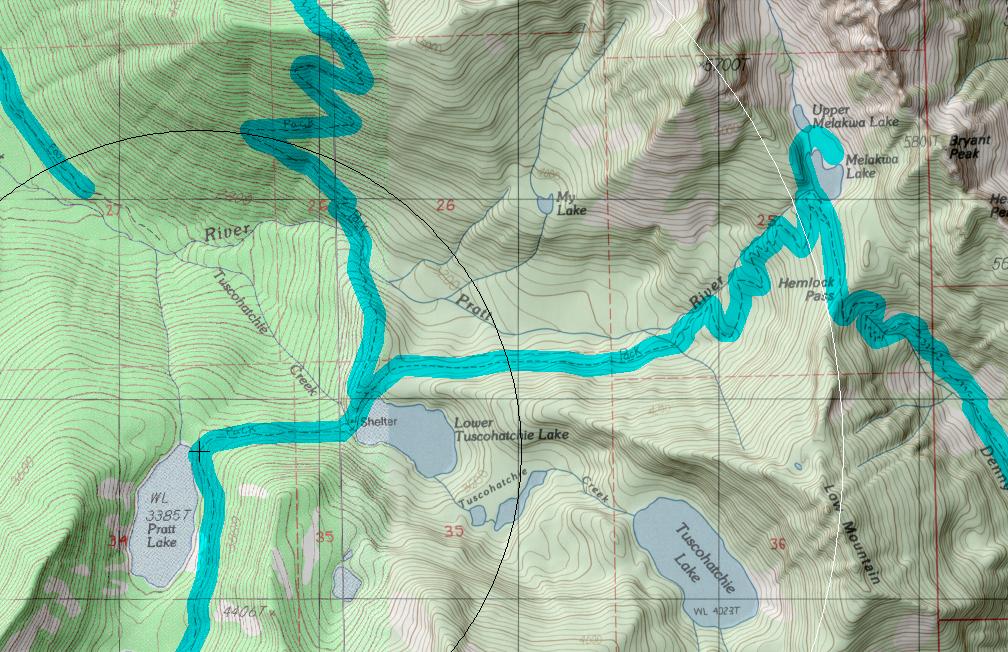
Melakwa Lake Trail #1011 Directions: I-90 to exit #47. Go north. Turn left at the "T". Pratt Lake Trail #1007 trailhead is 0.25 mile down the road, on the right side.
Follow Pratt Lake Trail #1007 for 5.5 miles to the north end of Pratt Lake. The junction with the Melakwa Lake Trail is in the small camping area.
This trail can also be accessed via the Denny Creek Trail #1014. 1
Attractions & Considerations: This is a moderately used trail connecting the Pratt Lake area with the Melakwa Lake area. The trail rises gradually for the first 2 miles, ending with a series of switchbacks to Melakwa Lake. After leaving Pratt Lake the trail passes by the north shore of Lower Tuscohatchie where the Kaleetan Lake Trail #1010 leads to the left. Beyond Tuscohatchie the trail continues for two miles (with little elevation gain) through old growth forest with occasional views of the Pratt River valley and Kaleetan Peak. At 3 miles there is a junction with the Denny Creek Trail #1014 at Melakwa Lake. Melakwa Lake is beautiful with clear green water and surrounding views of Bryant Peak from the east and Chair Peak from the northeast side. 1
1Source: USFS Trail Guide
return to Alpine West Home Page
Gregg Petrie ©2000