| Apline Lakes:West Home | Contact Infomation | Statistics Explained | Map Information | Scope |
|---|
STATISTICS:
|
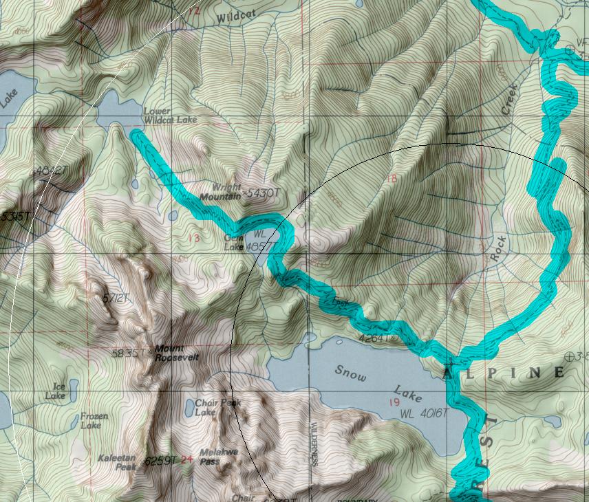
click on map to zoom in for trail location
|

High Lakes Trail #1012 Directions: Exit #52 from I-90. Turn north off the exit ramp and drive under the overpass. In 0.25 mile take the second right towards the Alpental Ski Area and park in the large lot to the left of the gate.
Hike the Snow Lake Trail #1013, eaving from the east side of the lot, for three miles until the junction with Rock Creek trail #1013.1 to the right, and the High Lakes Trail #1012 taking off from the left.
The trail can also be accessed via the Middle Fork Road #56 and the Rock Creek Trail. 1
Attractions & Considerations: The High Lakes Trail winds its way through subalpine meadows and stands of trees. The two mile route from Snow Lake to Gem Lake is extremely well traveled a nd can be very muddy in places. Use extreme caution not to further the destruction of this over-used high country. Camp and travel only on pre-established trails and campsites. Campfires are prohibited within 0.25 mile of Gem Lake in an attempt to restore the damage imposed upon the vegetation in this area. Another two miles beyond Gem Lake the trail drops over the back side of a saddle to Wildcat Lake, a good destination for those seeking more solitude. 1
1Source: USFS Trail Guide
return to Alpine West Home Page
Gregg Petrie ©2000