| Apline Lakes:West Home | Contact Infomation | Statistics Explained | Map Information | Scope |
|---|
STATISTICS:
|
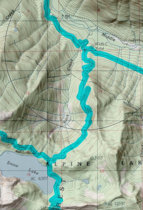
click on map to zoom in for trail location
|
Rock Creek Trail #1013.1 Directions: I-90 to exit 34. Turn north on 468th Avenue. In 0.6 mile turn right onto SE Middle Fork Road #56. Stay on Road #56 for 12.2 miles just after the bridge crossing. At the junction turn right to continue on Road #56. In 1.0 mile Road #56 turns left. Continue for approximately 5 miles to the Dingford Creek trailhead (parking is on the right side).
Drop to the river, cross and hike upstream on the Middle Fork Trail #1003 for 3.4 miles to Rock Creek. At the junction just beyond the creek turn right, uphill, on Trail #1013.1, paralleling Rock Creek.
The Rock Creek Trail #1013.1 can also be accessed via the Snow Lake Trail #1013. 1
1Source: USFS Trail Guide
return to Alpine West Home Page
Gregg Petrie ©2000