| Apline Lakes:West Home | Contact Infomation | Statistics Explained | Map Information | Scope |
|---|
STATISTICS:
|
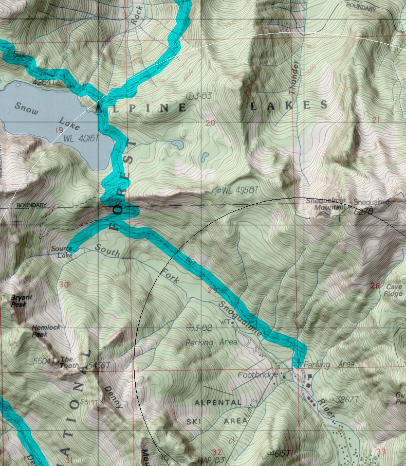
click on map to zoom in for trail location
|

Snow Lake #1013 Directions: I-90 to exit #52. From the exit, turn north and take the second right onto Alpental Road. Continue for 1.5 miles and park in the large gravel lot to the left. The trailhead is on the right 1
Attractions & Considerations: Snow Lake Trail is one of the most frequented trails in the greater Seattle area and can be a very crowded hike. The trail begins at a flat grade traveling through a series of avalanche chutes and groves of large trees. At 2.0 miles there is a spur trail, which goes 0.5 mile to Source Lake. Snow Lake Trail #1013 turns sharply right at this point and switchbacks up the ridge before dropping down to lake level. At the top of the ridge a large rock outcropping offers an overlook of the lake and is a popular destination for day hikers. The main trail stays to the right at the top of the ridge and continues to the far side of the lake, where it junctions with the Rock Creek Trail #1013.1 and the High Lakes Trail #1012. 1
1Source: USFS Trail Guide
return to Alpine West Home Page
Gregg Petrie ©2000