| Apline Lakes:West Home | Contact Infomation | Statistics Explained | Map Information | Scope |
|---|
STATISTICS:
|
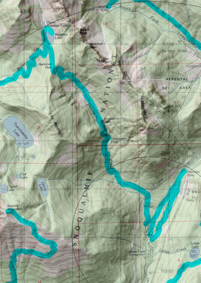
click on map to zoom in for trail location
|

Denny Creek Trail #1014 Directions: I-90 to exit #47. Turn north at the exit ramp, go over the interstate and turn right at the "T" in the road. In 0.25 mile turn left on Denny Creek Road #58. Follow the road 2.5 miles; just beyond the Denny Creek Campground turn left on the paved road. Continue 0.25 mile to the end of the road. Parking is limited; be sure to park off the right-of-way and do not block the driveways .1
Attractions & Considerations: This trail begins in an old forest, continuing about one mile with minimal elevation gain before crossing a bridge over Denny Creek. Here, large slabs of exposed bedrock create a natural waterslide. It is a popular place for picnics in the summer. The trail climbs up the river valley passing several waterfalls and offering open views of nearby peaks. At Hemlock Pass the trail peaks before dropping slightly into Melakwa Lake basin, shortly after the junction with Melakwa Lake Trail #1011 to Lower Tuscohatchie Lake 1
1Source: USFS Trail Guide
return to Alpine West Home Page
Gregg Petrie ©2000