| Apline Lakes:West Home | Contact Infomation | Statistics Explained | Map Information | Scope |
|---|
STATISTICS:
|
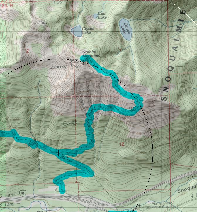
click on map to zoom in for trail location
|

Granite Mountain Trail #1016 Directions: I-90 to exit #47. Turn north from the off-ramp and turn left at the "T" in the road. Continue straight ahead and park in the Pratt Lake trail parking area. Hike the Pratt Lake Trail #1007 for one mile, where the junction for Granite Mountain turns sharply to the right and up the hill. .1
Attractions & Considerations: The trail rises steeply to the summit of the mountain for almost its entire length. In places it can be badly rutted out by water erosion. The trail climbs up the mountain's south face, making water sources scarce, if not obsolete, by mid-summer. However, this slope is covered with huckleberries and wildflowers in the mid to late summer making the hike well worth the effort. After three miles the trail crosses over the ridge onto its north side. Early in the season, this trail is usually snow covered and hikers often scramble along the ridge through the boulder field. If continuing on the trail, please use extreme care to stay on the main trail and prevent any further damage in this fragile alpine ecosystem. Awaiting visitors at the end of this trail is one of the last operational lookout towers in the forest, as well as sweeping panoramic views on clear days 1
1Source: USFS Trail Guide
return to Alpine West Home Page
Gregg Petrie ©2000