| Apline Lakes:West Home | Contact Infomation | Statistics Explained | Map Information | Scope |
|---|
STATISTICS:
|
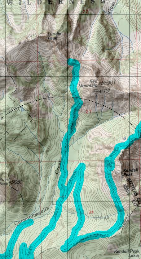
click on map to zoom in for trail location
|

Commonwealth Basin Trail #1033 Directions: I-90 to exit #52. Turn north at the exit ramp, and take the first right into the PCT-North parking area. The lot to the left is intended for stock; hikers can continue straight to the main parking lot. The trail starts at the east end of the parking lot .1
Attractions & Considerations: Begin at the Pacific Crest Trail #2000, following it for 2.5 miles to a junction. Take the left fork (Trail #1033). On the west side of Commonwealth Creek, the trail rises steeply, switch backing up a ridge. It levels out at Red Pond and then begins another series of switchbacks. About 0.5 mile above Red Pond the trail ends at Red Pass. This is an excellent spot for a lofty lunch. Views are good in all directions - especially towards the Middle Fork Snoqualmie River and Thompson Peak. 1
1Source: USFS Trail Guide
return to Alpine West Home Page
Gregg Petrie ©2000