| Apline Lakes:West Home | Contact Infomation | Statistics Explained | Map Information | Scope |
|---|
STATISTICS:
|
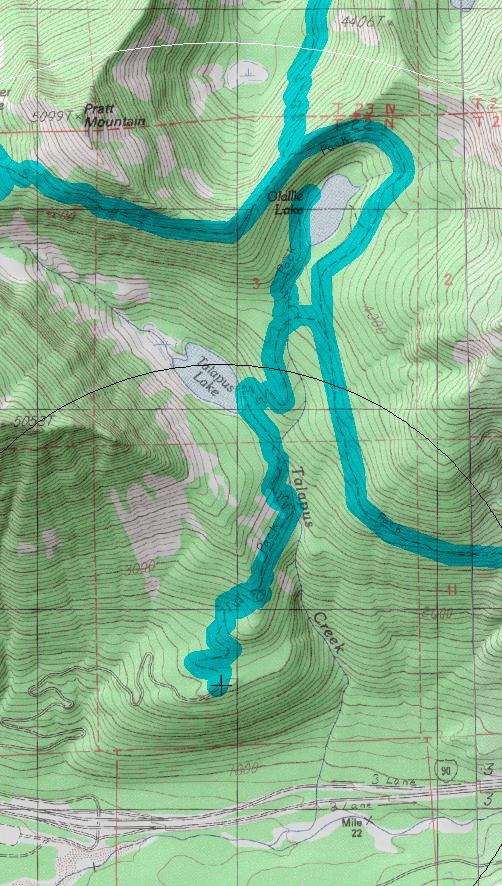
click on map to zoom in for trail location
|

Talapus Lake Trail #1039 Directions: I-90 to exit #45. At the stop sign turn north. Turn left on Road #9030. Follow Road #9030 for 0.75 mile and turn right at the junction, following Road #9030 uphill to the trailhead at the end of the road. 1
Attractions & Considerations: This moderate hike is very popular with first time backpackers and families with children. The trail begins on an overgrown logging road through an old clearcut, enters forest shade and switchbacks up a hillside to a marshy area below Talapus Lake. Paths here branch in several directions. The main trail crosses the outlet on a bridge and at 2.0 miles comes to Talapus Lake (a good stopping point). The trail continues 1.25 miles to Olallie Lake. This area offers little privacy or seclusion due to overuse. 1
1Source: USFS Trail Guide
return to Alpine West Home Page
Gregg Petrie ©2000