| Apline Lakes:West Home | Contact Infomation | Statistics Explained | Map Information | Scope |
|---|
STATISTICS:
|
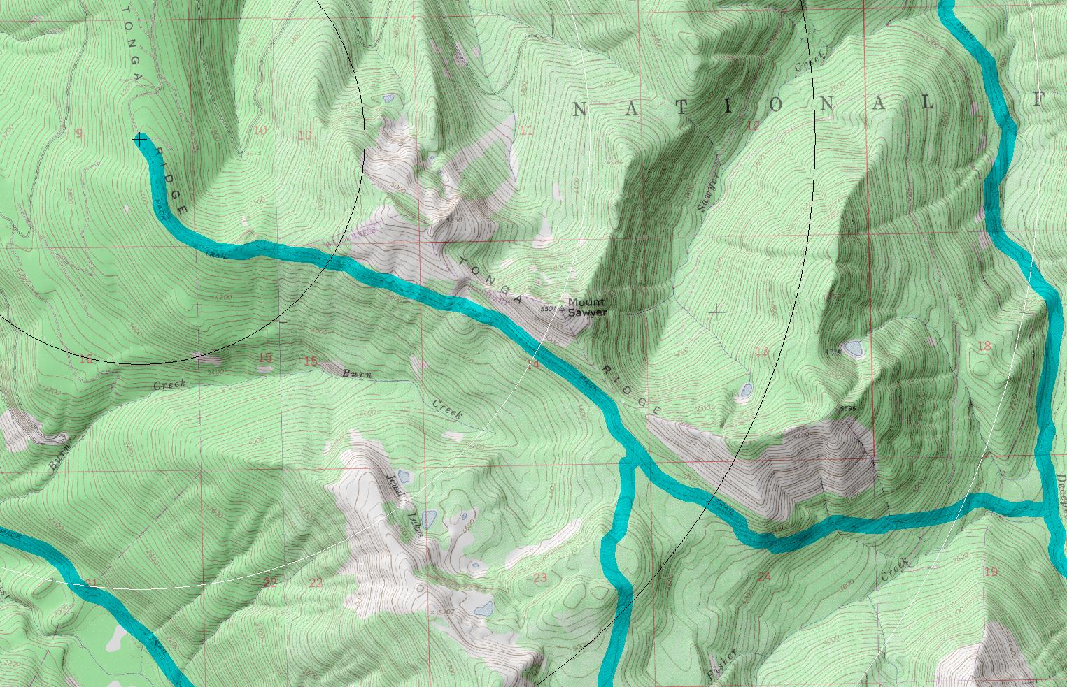
click on map to zoom in for trail location
|
Tonga Ridge Trail #1058 Directions: Drive State Route 2 for 1.7 miles east of the Skykomish. Turn south onto Foss River Road #68. Continue on Road #68 for 3.5 miles to its junction with #6830 road. Turn left onto Road #6830. Continue for 6.0 miles to the 310 spur road. Turn right onto the spur and drive 1.0 mile to the end of the spur at the trailhead.1
Attractions & Considerations: The first mile of this south-facing trail is uphill, not too steep though, slowly climbing through second growth timber into open meadows. The next couple of miles cut straight across a steep hillside with a few trees along the way for shade. The views across the valley to the Alpine Lakes Wilderness are spectacular. The last half mile is through woods and meadow. The meadow at the end of the trail, Sawyer Pass, is beautiful, and you can find some nice campsites here. There is no water along this trail. 1
1Source: USFS Trail Guide
return to Alpine West Home Page
Gregg Petrie ©2000