| Apline Lakes:West Home | Contact Infomation | Statistics Explained | Map Information | Scope |
|---|
STATISTICS:
|
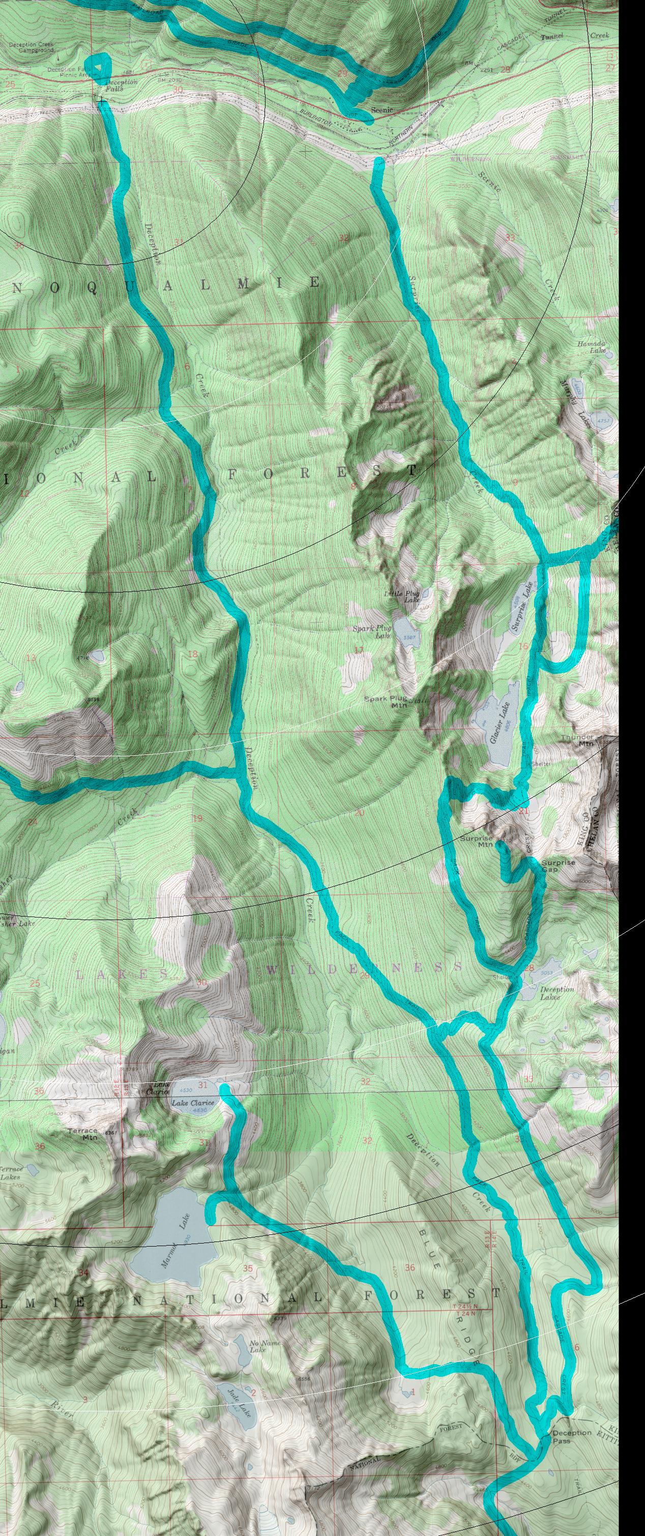
click on map to zoom in for trail location

|
Deception Creek Trail #1059 Directions: Drive State Route 2 going 7.8 miles east of the Skykomish. Turn south onto the Deception Creek Road #6088. Continue on Road #6088 for 1.0 mile to the trailhead..1
Attractions & Considerations: The first five miles of this trail gradually ascend the valley, generally following Deception Creek. Campsites are plentiful in areas close to the creek. At mile 7.8, Trail #1059.2 may be taken to connect with the Pacific Crest Trail or to reach Deception Lakes. The last 2.8 miles climb through sub-alpine meadows to intersect with the Pacific Crest Trail at Deception Pass. 1
1Source: USFS Trail Guide
return to Alpine West Home Page
Gregg Petrie ©2000