| Apline Lakes:West Home | Contact Infomation | Statistics Explained | Map Information | Scope |
|---|
STATISTICS:
|
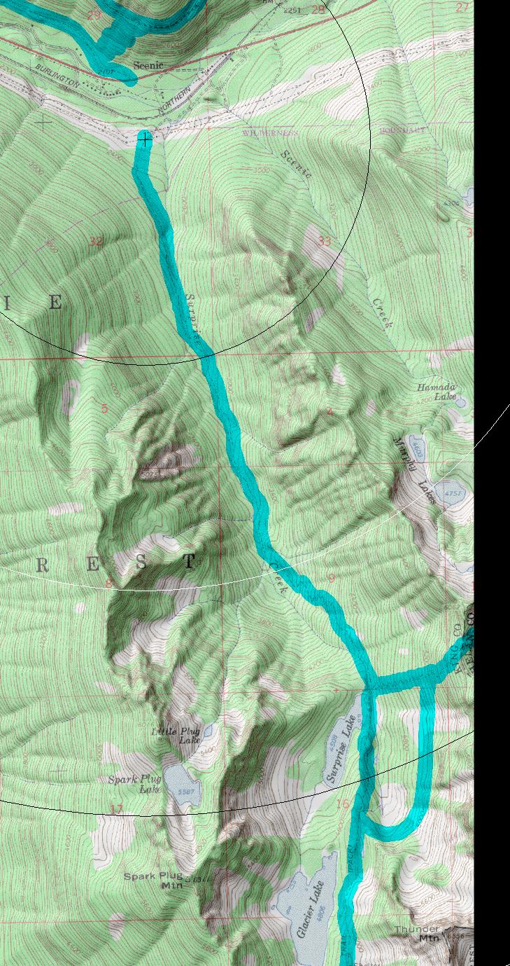
click on map to zoom in for trail location
|

Surprise Creek Trail #1060 Directions: Drive State Route 2 to milepost 58.7. Turn south onto an unmarked road to the service center for Burlington-Northern. Cross the railroad tracks. Turn on to the spur road on the far right. Continue for 0.2 mile to the trailhead. 1
Attractions & Considerations: The trail starts out under power lines but quickly finds the shade of giant trees on a well maintained trail. You will hike for about a mile before you reach a foot log that crosses Surprise Creek. If your feet are still dry after that, you'll get another chance in half of a mile, where you'll be crossing the creek again. All along the trail you can catch glimpses of beautiful waterfalls (ranging from 2 to 6 feet) and icy clear pools. After 2.5 miles, the hike steepens as you head east on the trail a nd begin switchbacking up the side of the valley. You'll travel up the valley wall for about a mile on the switchbacks gaining close to 1000 feet in elevation. At the top, you can catch an awe-inspiring mountain view through a gap between the two ridges through which you will pass. Here you'll find the trail that links to the Pacific Crest National Scenic Trail (PCT), and down the other side of the gap is Surprise Lake. At the lake, there are great rocks to lounge on while enjoying the view1
1Source: USFS Trail Guide
return to Alpine West Home Page
Gregg Petrie ©2000