| Apline Lakes:West Home | Contact Infomation | Statistics Explained | Map Information | Scope |
|---|
STATISTICS:
|
click on map to zoom in for trail location
|
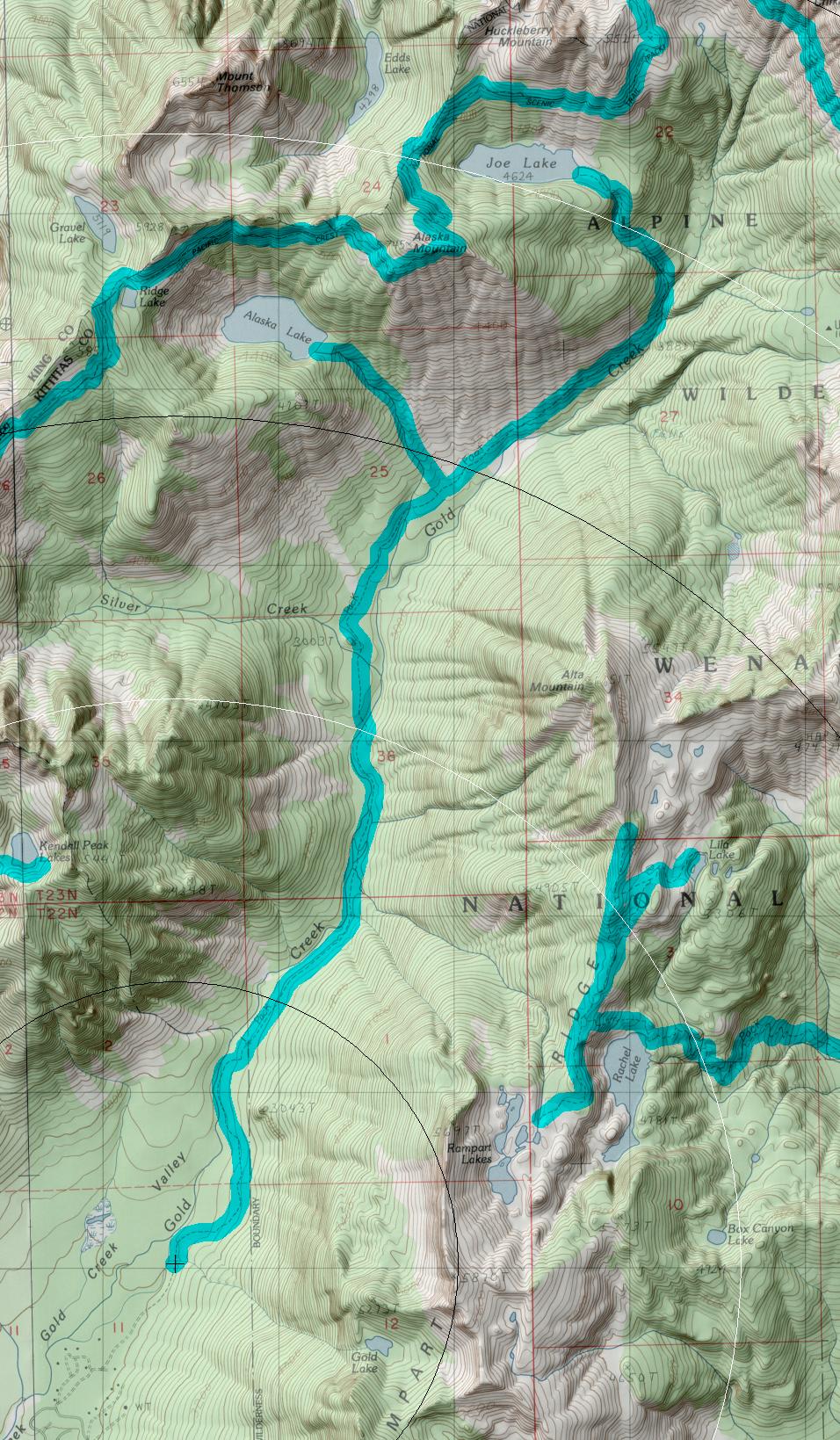
Gold Creek Trail #1314 Directions: Drive I-90 to Hyak exit #54. Turn left at the stop sign, then right on Forest Service road 4832. Follow the parallel road north of I-90 for approximately 1.5 miles to Forest Service Road #142 (Gold Creek road). Turn left. Follow FS Road #144 for half-mile turn left to Gold Creek Pond parking lot. Walk the Gold Creek Pond trail to the first junction. Turn right and continue to the second junction (approximately quarter-mile from the trailhead). Turn right and climb to the road. Follow signs for 1 mile along the road passing private property, until the road becomes the trail. .1
Attractions & Considerations: The Gold Creek Trail wanders up the valley through old growth timber with views of the creek. At 2.3 miles the trail enters the Alpine Lakes Wilderness. At 4.3 miles the trail crosses Gold Creek by wading. In late summer the water is usually low and can be forded easily. There are a few good campsites along the creek. At 5.3 miles the maintained trail ends at a junction. Beyond this point the trails are not maintained thus overgrown and difficult to follow. The left fork climbs one steep mile through vine maple, alder and talus (rockslide) to Alaska Lake at 4,230 feet. The right fork proceeds 1.75 miles up the main valley climbing through avalanche greenery and forest, reaching the base of Alaska Mountain. A steep, hazardous boot path on a staircase of rocks and roots climbs to Joe Lake at 4,624 feet. 1
1Source: USFS Trail Guide
return to Alpine West Home Page
Gregg Petrie ©2000