| Cle Elum Alpine Lakes Home | Contact Infomation | Statistics Explained | Map Information | Scope |
|---|
STATISTICS:
|
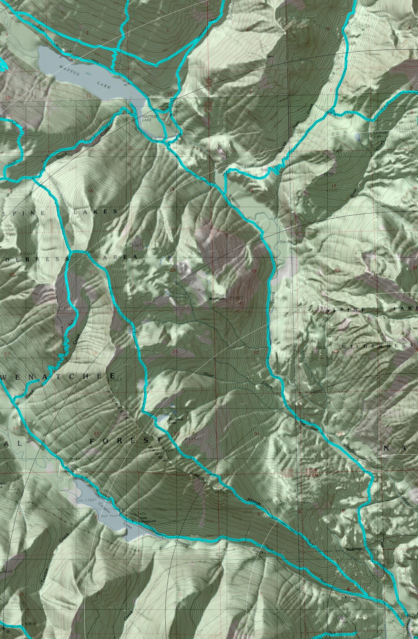
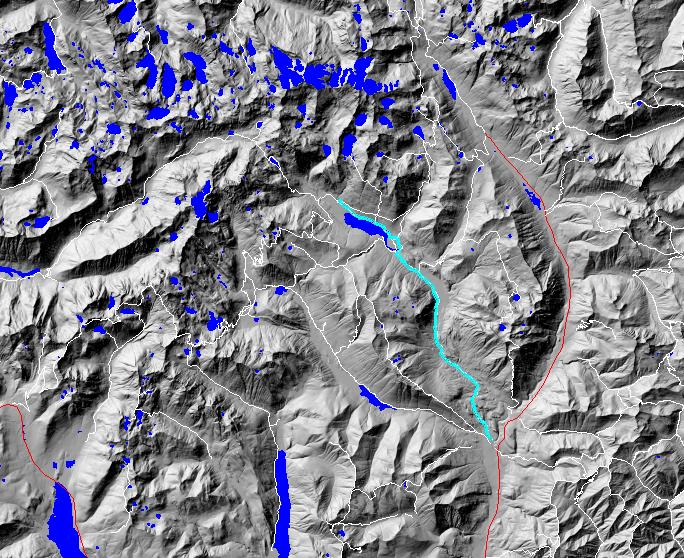
click on map to zoom in for trail location
|
TRAILHEAD ACCESS: From Cle Elum and/or Roslyn, take State Highway 903 north to Salmon La Sac, then turn left on FS Road 4316 and take spur Road 111 to the trailhead. This is also the trailhead for Cooper River Trail #13 11 and Pollalie Ridge Trail #1309.
PARKING AND FACILITIES: Facilities include parking, toilets, and stock ramps.
TRAIL: Follows a gentle grade for most of its length, with several uphill and downhill stretches over the first 6 miles as it winds among rocky bluffs and ponds, through forest, and eventually along Waptus River. From the 6-mile point, the trail is level for a while before starting uphill and leaving the river near the junction with Trail Creek Trail #1322. Two miles later, the trail reaches the junction with Waptus Pass Trail #1329; from here the hiker trail is to the right and heads down to the river and a bridge crossing, then it follows Spinola Creek north for 0.5 mile and crosses it on a bridge before heading west 0.5 mile to Waptus Lake. On the west side of Spinola Creek is the junction with Spinola Creek Trail #13 10.1 which heads north up the creek for 1 mile to a junction with the Pacific Crest Trail. Horsemen can use the Waptus Horse Ford Trail #1329.1, which crosses the river 0.25 mile upstream of the hiker bridge and is accessed from #1 329; it then heads straight to the lake where it meets #1310 again. From that junction, #1310 continues on a fairly level grade along the north shore of Waptus Lake for 1.5 miles. It then leaves the lake behind and heads uphill through forest for 0.5 mile to trailĺs end at the junction with Pacific Crest Trail #2000 near Spade Creek.
SETTING: River valley, old-growth forest, meadow, bluffs, lake.
OPPORTUNITIE5: Hiking, horseback riding, scenery, photography, wildlife. fishing, hunting, camping.
OTHER TRAILS: Trail Creek #1322, Waptus Pass #1329, Spinola Creek #13 10.1, Waptus Horse Ford #1329.1, Spade Lake #1337, Pacific Crest Trail #2000.
Gregg Petrie ę2000