
| Cle Elum Alpine Lakes Home | Contact Infomation | Statistics Explained | Map Information | Scope |
|---|
STATISTICS:
|
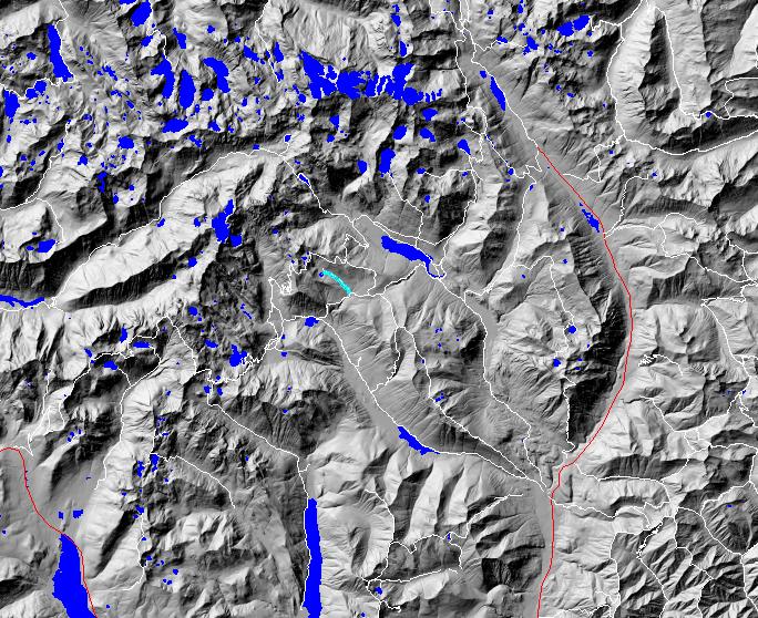
click on map to zoom in for trail location
|
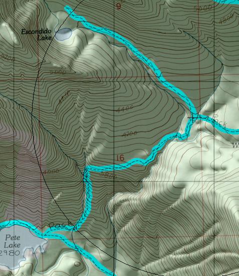
TRAILHEAD ACCESS: This trail has no trailhead. Shortest access is from Waptus Pass Trail #1329 via Pete Lake and Pete Lake Trail #1323.
TRAIL: From its junction with Trail #1329, this trail heads uphill through forest along the north side of Escondido Creek, which is often out of sight in the trees below. There are several steep stretches on this trail, but the overall grade is fairly easy. Near the lake, the trail passes by and through some meadows along the creek. Then it reaches the edge of a large meadow and turns left to the lake.
SETTING: Creek valley, old-growth forest, meadows, lake.
OPPORTUNITIES: Hiking, horseback riding, scenery, photography, wild-flowers, hunting, fishing, camping.
OTHER TRAILS: Waptus Pass #1329.
Gregg Petrie ©2000