| Cle Elum Alpine Lakes Home | Contact Infomation | Statistics Explained | Map Information | Scope |
|---|
STATISTICS:
|
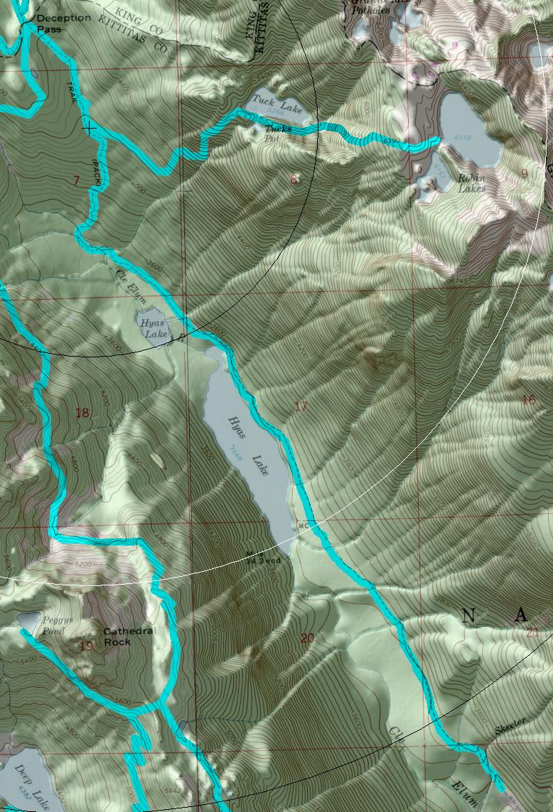
click on map to zoom in for trail location
|

TRAILHEAD ACCESS: This trail has no trailhead. Access is from Deception Pass Trail #1376.
TRAIL: From the junction with #1376, the trail heads southeast along the mountainside and through forest. After 1 mile, it begins a steep climb, winding through the trees and bluffs. After about 0.5 mile, the trail reaches more level ground and comes into the semi-open area around Tuck Lake, which is surrounded by rounded, glacier polished granite bluffs. From here, the trail can be indistinct at times as it crosses the rocks, but cairns mark its course; it passes between the lake and Tucks Pot and heads up a series of rock bluffs, curves left into a gully, climbs up the middle of the steep cirque, reaches level ground, and continues east to Robin Lakes. Campfires are prohibited within 0.25 of Tuck Lake and above 5,000 feet. Please remember to camp away from the lakeshores and at established sites. Campfires are prohibited at this and all areas above 5000 feet in the Alpine Lakes Wilderness.
SETTING:Old-growth forest, subalpine forest, meadows, rock outcrops, lakes.
OPPORTUNITIES: Hiking, scenery, photography, wildlife, mountain climbing, rock scrambling, camping.
OTHER TRAILS: Deception Pass #1376.
Gregg Petrie ©2000