
| Great Lakes Home | Contact Infomation | Statistics Explained | Map Information | Scope |
|---|
STATISTICS:
|
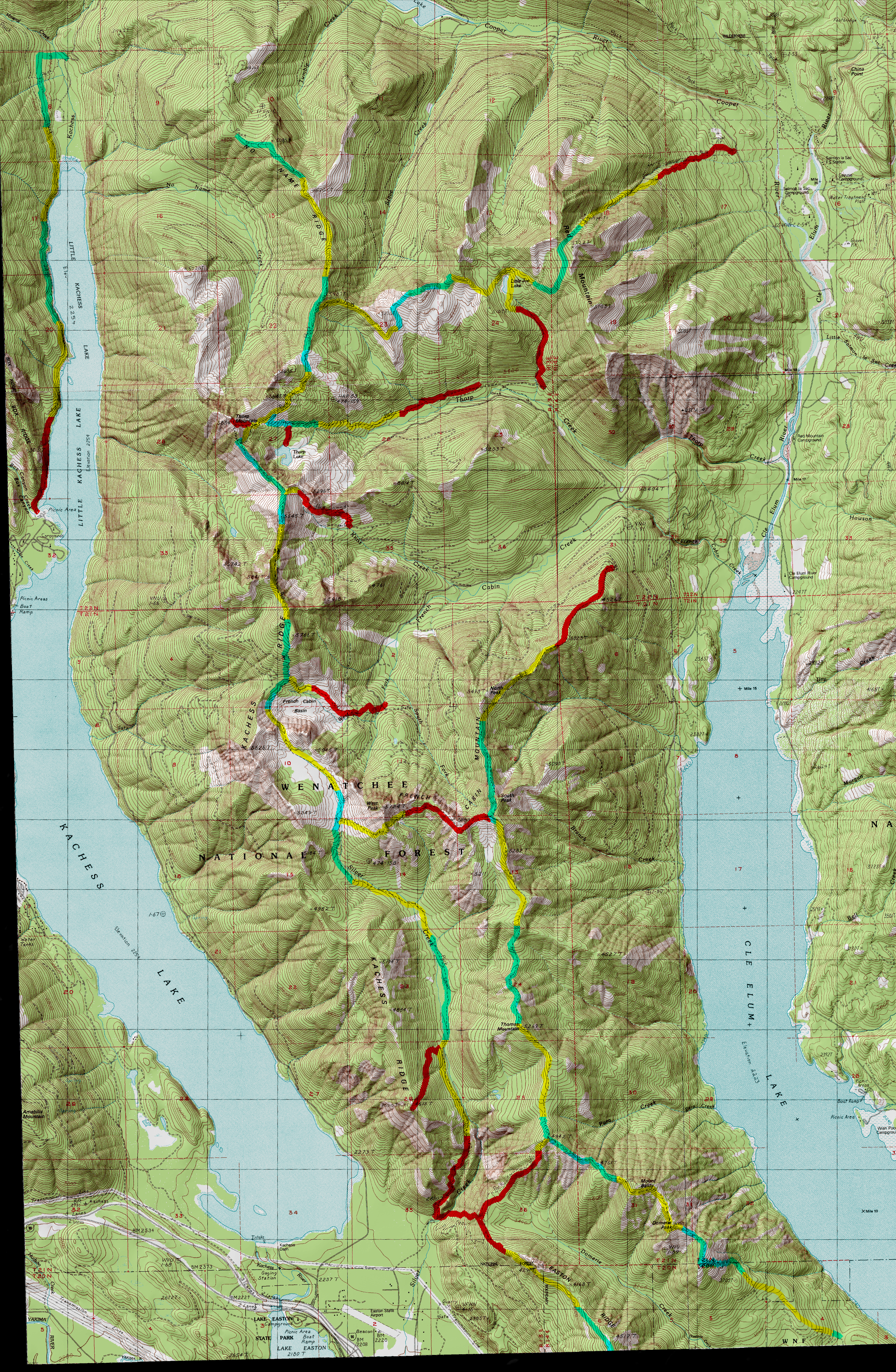
click to expand sample map to USGS topographic trail map
|

- (1)1331 Mineral Creek Trail Junction
Text Source:Cle Elum Range District Trail Guide
TRAILHEAD ACCESS: From 1-90 exit 62, go northeast to Kachess Campground, north in the campground to road’s end at the trailhead.PARKING AND FACILITIES: All normal campground facilities are available near this trailhead. There is parking for 15+ vehicles at or near the trail head.
TRAIL: Crosses Box Canyon Creek on a unique bridge and is quite flat for the first 0.25 mile. This stretch of trail is now barrier-free and accessible to wheelchairs; there is a rail-enclosed wooden platform at a viewpoint overlooking the lake. It then turns into a very rugged trail that climbs and descends frequently in an effort to avoid glaciated rock, cliffs and other obstructions. The trail parallels the shoreline of Little Kachess Lake but only gets close to the water in a few places. Near the north end of the lake, one mile of new trail was constructed in 1989 to move the trail out of a large clearcut and put it within sight of the lake. The northern terminus of the trail is at the junction with Mineral Creek Trail #1331. The first 0.25 mile of this trail has been reconstructed to meet barrier-free standards
SETTING: Lake, streams, riparian zones, glaciated rock, large old-growth trees, valley bottom.
OPPORTUNITIES: Hiking. scenery, fishing, wildlife, camping, boating.
OTHER TRAILS: Kachess Lake Shore #1302 and Kachess Nature #1395
within Kachess Campground, Mineral Creek #1331.
Return to Land Between the Lakes Trail Index
Gregg Petrie ©2000