
| Leavenworth Home | Contact Infomation | Statistics Explained | Map Information | Scope |
|---|
STATISTICS:
|
click on map to zoom in for trail location
|
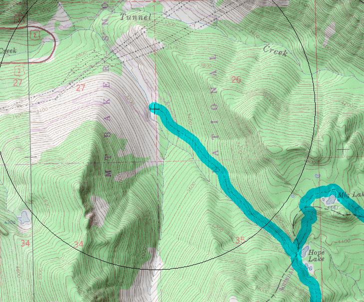
1061: Tunnel Creek: Directions: Drive State Route 2 for 13.2 miles east of the Skykomish. Turn right onto Tunnel Creek Road #6095. Continue on Road #6095 for 1.5 miles staying left at the junctions to the trailhead
The elevation gain is continual on this hike. At its end, the trail meets the Pacific Crest National Scenic Trail (PCT) near Hope Lake. After reaching the PCT, a short side trip north for 0.5 mile leads to Mig Lake. Tunnel Creek is a noteworthy spot for picking berries in the fall.
text source:
http://www.fs.fed.us/r6/mbs/recreation/activities/trails/skykomish.shtml
Gregg Petrie ©2000