| Leavenworth Home | Contact Infomation | Statistics Explained | Map Information | Scope |
|---|
STATISTICS:
|
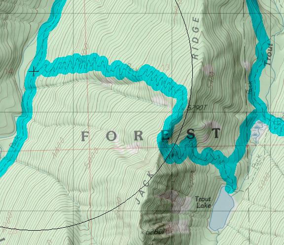
click on map to zoom in for trail location
|

1557: Trout Lake Directions: Drive East on Highway 2 over Stevens Pass (or west from Wenatchee) to Leavenworth. From the far west side of town turn south on Icicle Creek Road (USFS road 7600) and drive for 15.5 miles , just past the Information center, to the Jack Creek trail head. The Trout Creek trail head is just over 4 miles up the Jack Creek trail
Gregg Petrie ©2000