
| Leavenworth Home | Contact Infomation | Statistics Explained | Map Information | Scope |
|---|
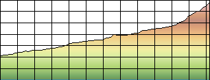
STATISTICS:
|
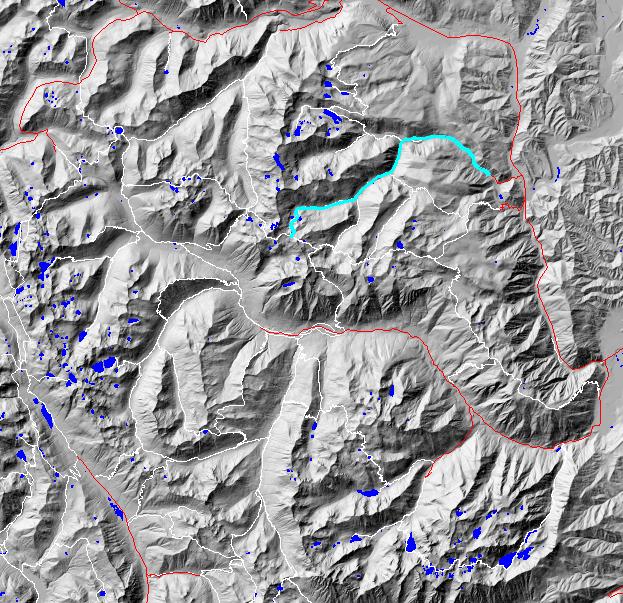
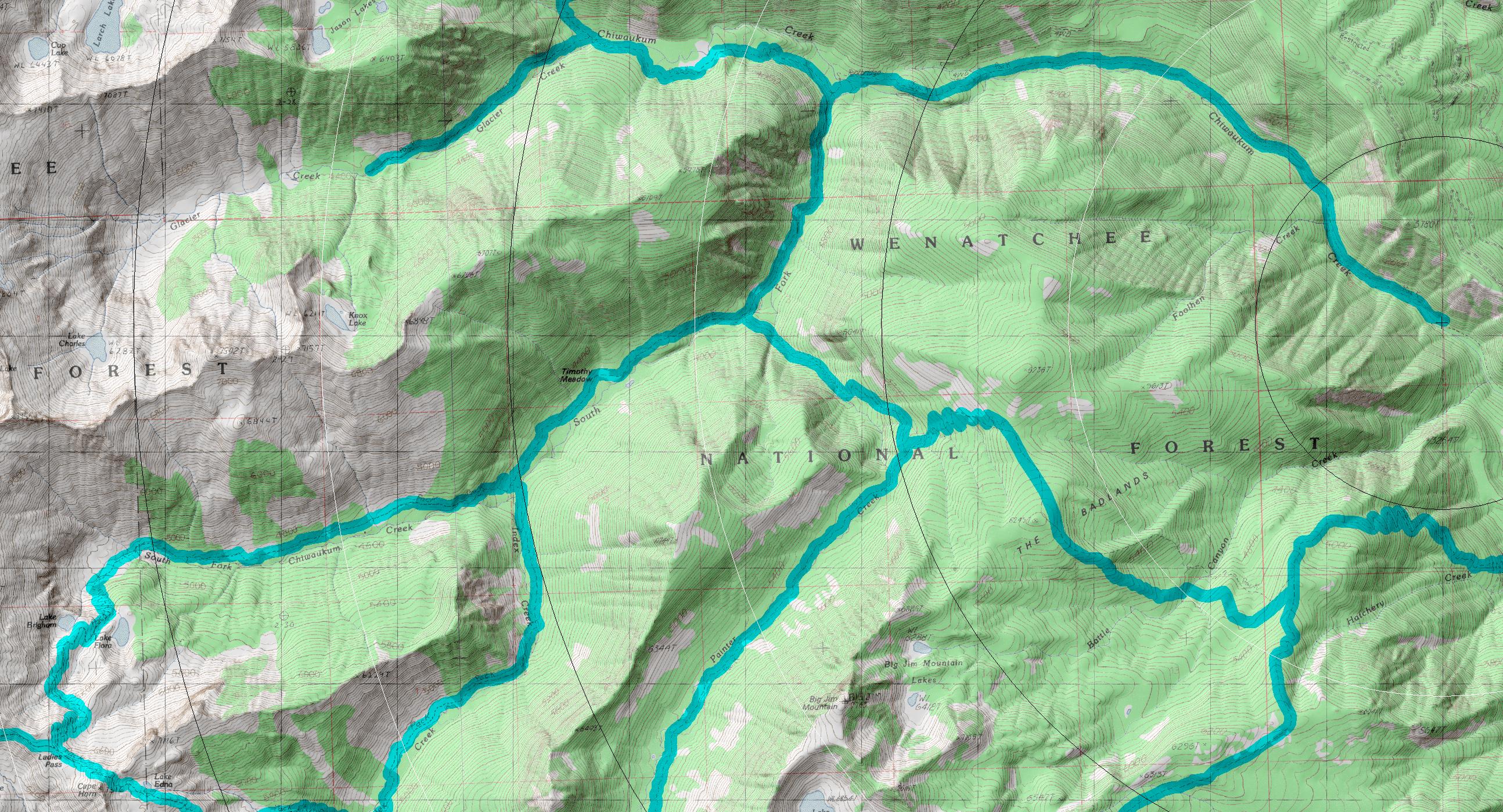
click on map to zoom in for trail location
|
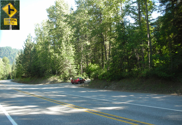
Directions: From the north turn from US 2 west onto USFS road 7980 (A.K.A. Chiwaukum CR. RD; .8 north of the Tumwater Campground or 5 miles south from Coles Corner) and follow it the Chiwaukum Creek (1571) trailhead (note that if the road is gated (which it has been for many years) you will have to add 1.2+ miles to your hike).
Gregg Petrie ©2000