
| Leavenworth Home | Contact Infomation | Statistics Explained | Map Information | Scope |
|---|
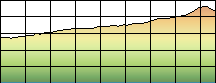
STATISTICS:
|
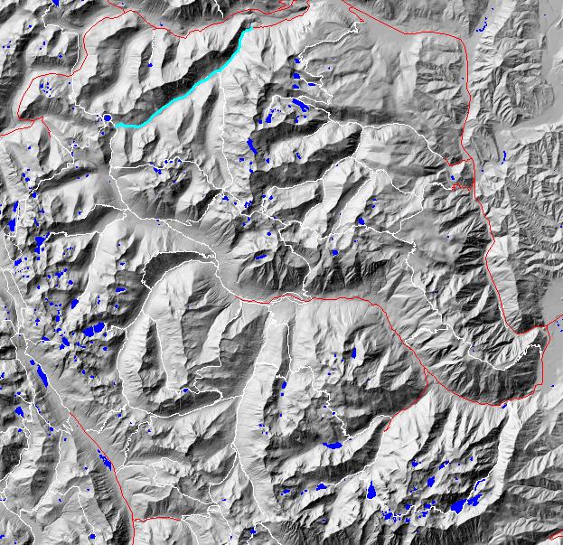
click on map to zoom in for trail location
|
1582 Whitepine Creek Directions: Take US 2 to the Whitepine Road (USFS 6950). The turnoff for6950 is 14 miles east from Stevens Pass or 6.5 miles east of Coles Corner on the south side of the highway. Follow 6950 for about 3.1 miles to the trailhead at road’s end
Gregg Petrie ©2000
