
| Teanaway Basin Home | Contact Infomation | Statistics Explained | Map Information | Scope |
|---|
STATISTICS:
|
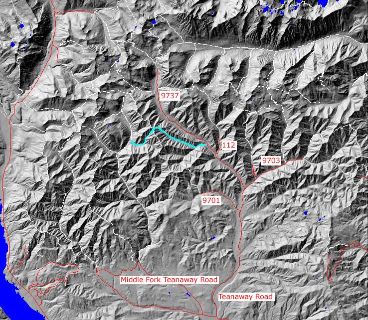
click on map to zoom in for trail location
|
TRAILHEAD ACCESS:
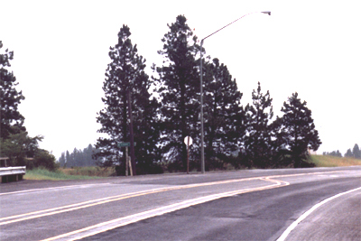
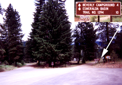
- From Highway 970 turn north onto the Teanaway Road(image size=104k)
- Follow the Paved Teanaway Road up the North Fork to the end of the pavement(12.75 miles)
- Take a right(signed for Beverly Campground) onto FS Road 9737 and follow it up the North Fork.
- The Trailhead is on the left just past the Beverly Campground
PARKING AND FACILITIES: Roadside parking is available
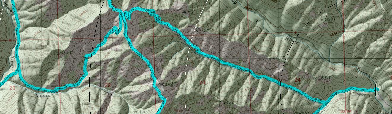
TRAIL: The trail follows Johnson Creek and at approximately the 0.5 mile points heads off to the right up the North Fork of Johnson Creek while Jungle Creek Trail (=#1383,1 takes off to the left. Past the junction, the trail gets steeper as it follows the narrow and steep valley of Johnson Creek. Near the head of the valley a series of switchbacks takes the trail to the top of the ridge and a junction with Koppen Mountain Trial #1225, which heads north along the ridge. There are excellent views of the surrounding country from the bare ridgetop. Trail #1383 continues over the ridge and down into the valley of Medra Creek. From here on down to the junction with the Middle Fork Teanaway Trial #1393 the trail is hiker only due to hazardous conditions. It is steep and rough at first and in some places the tread is gone, but the trail improves as it switchbacks down into the valley. From sparse trees, brush, and grass, the trail enters thicker forest as it heads downhill. It remains moderately steep all the way to its end at the junction with the Middle Fork Teanaway Trail #1393. Water is not available along much of this trail later in the season.
SETTING: Creek, valleys, forest, meadows, rock bluffs, ridgetop
OPPORTUNITIES: Hiker, horseback riding, motorcycle riding, mountain biking, scenery, photographic, hunting, camping
OTHER TRIALS: Jungle Creek #1383.1. Koppen Mountain #1225 (not currently maintained), Middle Fork Teanaway #1393
return to Cle Elum Home Page
Gregg Petrie ©2000