| Teanaway Basin Home | Contact Infomation | Statistics Explained | Map Information | Scope |
|---|
STATISTICS:
|
click on map to zoom in for trail location
|
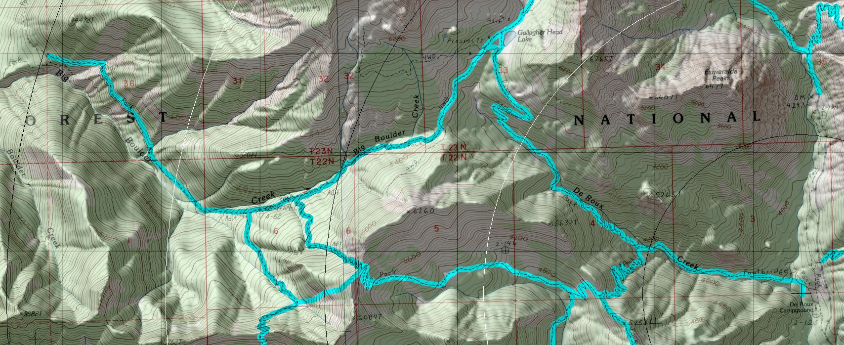
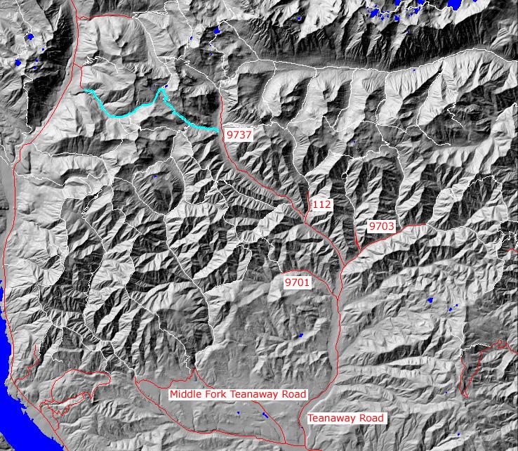
TRAILHEAD ACCESS: This trail has two trailheads located at its eastern and western ends. To reach the eastern trailhead: approximately 6 miles east of Cle Elum, turn off Highway 970 onto the Teanaway Road and follow it up the North Fork Teanaway to the end of the Pavement. Take a right onto FS Road 9737 up the North Fork; then left onto 9737-120 do De Roux Campground.
To reach the western trailhead: from Cle Elum or Roslyn, Take Highway 903 north to Salmon La Sac and then right into Fish Lake Road 4330. Follow 4300 about 7 miles and take a right into spur road 138. Then turn right onto spur road 140. Follow it to its end and park there.
PARKING AND FACILITIES: From the east: park at the campground turnaround. Facilities include camping, a pit toilet, and picnic tables.
From the west: there are no facilities
TRAIL: From the De Roux trailhead, the trail crosses the North Fork Teanaway River and heads west up the valley of De Roux Creek thought forest and some scatted meadows. After the first creek crossing (at 1 mile) the trail steepens and after the junction with De Roux Spur Trail #1392 (which is a 2-mile trail that connects with Middle Fork Teanaway Trail #1393), it starts switchbacking uphill thought scattered timber and bluffs until it cross a small ridge and continues up valley though denser timber and scattered meadows. After crossing the creek a couple of time. the trail nears the head of the valley and more open country. At 4.5 miles, the trail meets Fortune Creek #4W301(4X4); Gallagher Head Lake is to the right in a small rocky basin. Form the Boulder Creek trailhead on FS Road 4330-140, the trail climbs though scattered timber, on an old road(private), crosses around a ridge and enters the Boulder Creek canyon. The trail is then on a very old mining access wagon road of the next tow miles. It climbs steeply, then flattens out as it crosses a bare rocky hillside that is very erosive and washes out frequently. After this hillside, the trail varies in grade from flat to quite steep with the steep part beginning near the junction with South Fork Boulder Trail #1392.7 at about the 3 mile point. Trail #1392.7 head steeply uphill for about 0.75 mile until it ends at Paris Creek Trail #1393.1 approximately 0.25 mile past #1392.7, the Boulder Creek trail has a junction with Elsnor Mine Trail #1392.8; that trial climbs steeply though old growth and a meadow (near the runs of an historic mercury furnace) and after 1 mile ends at trail #1393 on the ridgetop between Middle Fork Teanaway and Boulder Creek. Beyond #1392.8 Boulder creek Trail continues upward and ends at the junction with trail 4W301 on the divide between Boulder and DeRoux creeks. Follow this trail to the left and tie into the DeRoux portion of the trail near Gallagher Head (Enis) Lake.
SETTING: Creek Valley, old-growth timber, hillside, steam, meadow, ridgetop, mining
OPPORTUNITIES: Hiking, horseback riding, motorcycling, mountain biking, scenery, photography, wildflowers, hunting, fishing, camping.
OTHER TRAILS: De Roux Spur #1392.1, S. Fk. Boulder #1392.7, Elsnor
Mine #1392.8, Fortune cr. #4W301.
return to Home Page
Gregg Petrie ©2000