
| Teanaway Basin Home | Contact Infomation | Statistics Explained | Map Information | Scope |
|---|
STATISTICS:
|
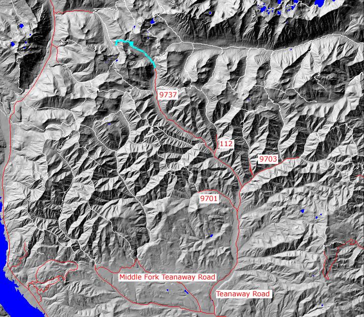
click on map to zoom in for trail location
|

TRAILHEAD ACCESS: Approximately 6 miles east of Cle Elum, Turn off Highway 970 onto the Teanaway road and follow it up the North Fork Teanaway to the end of the pavement. take a right onto FS Road 9737 and follow it up the North Fork to the end of the road.
PARKING AND FACILITIES: Facilities include lot and roadside parking, stock ramps, pit toilet, picnic tables.
TRAIL: From the trailhead, the trail heads up a steep slope along the river for about 0.5 mile and intersects with the Ingalls Way Trail #1390. Beyond the junction, the trail grade moderates as the rails goes on into Esmerelda Basin though meadows and groups of trees. There are some switchbacks along the trail as it continues upwards. Past the junction with County Line Trail #1226.2(formerly a part of #1394 which heads north towards Lake Ann), the trail goes over a ridge and then down a series of switchbacks into the south fork of Fortune creek, where it ends at the junction with FS #4W301(4X4). Water is available along the first few miles of the trail.
SETTING: Creek valley, meadow, forest, ridgetop, lake
OPPORTUNITIES: Hiking, horseback riding, scenery, wildflower viewing, photography, rock scrambling, hunting, camping.
OTHER TRAILS:
Ingalls Way #1390. County Line #1226.2, Fortune Creek#4W301(4X4)
return to Cle Elum Home Page
Gregg Petrie ©2000
