
| Teanaway Basin Home | Contact Infomation | Statistics Explained | Map Information | Scope |
|---|
STATISTICS:
|
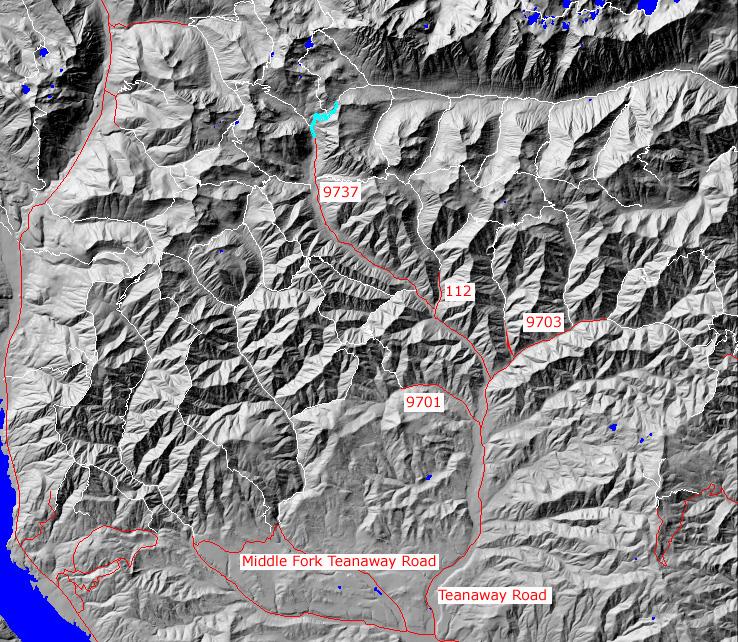
click on map to zoom in for trail location
|

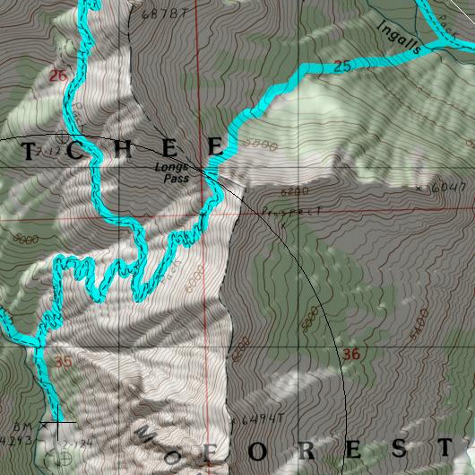
TRAILHEAD ACCESS: This trail has not tralhead. It is accessed from Ingalls Lake Trail#1390, which has a tralhead at the end of the North Fork Teanaway Road #9737
PARKIING AND FACILITIES: N/A
TRAIL: From it junction with #1390 in a rocky meadow, the trail switchbacks up a steep, bare, oracky mountainside, sometimes following an old mining "road" built in the 1930's. After a long mile, the trail reaches the top of the ridge where there are good views of Mount Start and the surrounding mountains. This trail is primarily a route for climbers on their way to Mount Start and it continues over the ridge (into the Leavenworth District), down into a basin and goes on down to Ingalls Creek at the base of Stuart. Limited-use permits are requiered for Upper Ingalls Creek.
SETTING: Meadow, ridgetop
OPPORTUNITIES: Hiking, scenery,photography, mountain climibing, camping
OTHER TRAILS: Ingalls Lake #1390, Ingalls Creek #1215
Gregg Petrie ©2000