| Teanaway Basin Home | Contact Infomation | Statistics Explained | Map Information | Scope |
|---|
STATISTICS:
|
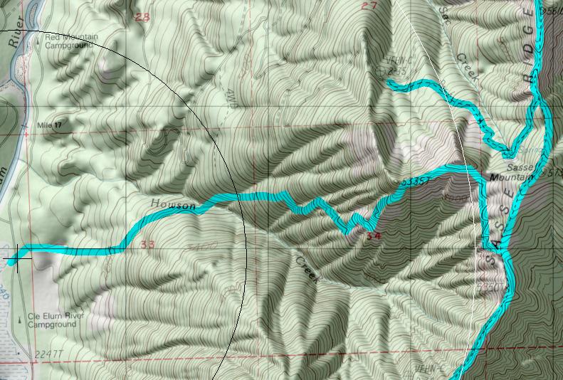
click on map to zoom in for trail location
|

TRAILHEAD ACCESS: Planned location is to be at Cle Elum River Campground on the east side of the highway. From Roslyn or Cle Elum, take state high 903 north along Lake Cle Elum to the campground, which is located at the upper end of the lake.
TRAIL: This is an old trail which has been abandoned for may years. Volunteer efforts have reopened most of this trail. From Cle Elum Campground the trail heads up the south side of Howson Creek for approximately 0.75 mile. then cross the creek and gets steeper as it heads up thought a clear-cut for 0.5 mile. This section through the clear-cut is very steep and difficult for stock. After leaving the clear-cut, the trail switches back up though old-growth and contour around the upper basin of Howson Creek to the top of Sasse Ridge, where it meets Sasse Mountain Trail #1340. Was is scarce on the upper part of the trail, particularly later in the season.
SETTING: Creek valley, clear-cut, old-growth, forest, ridgetop
OPPORTUNITIES: Hiking scenery, wildflowers, photography, camping
OTHER TRAILS: Sasse Mountain #1340
return to Home Page
Gregg Petrie ©2000