| Teanaway Basin Home | Contact Infomation | Statistics Explained | Map Information | Scope |
|---|
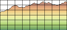
STATISTICS:
|
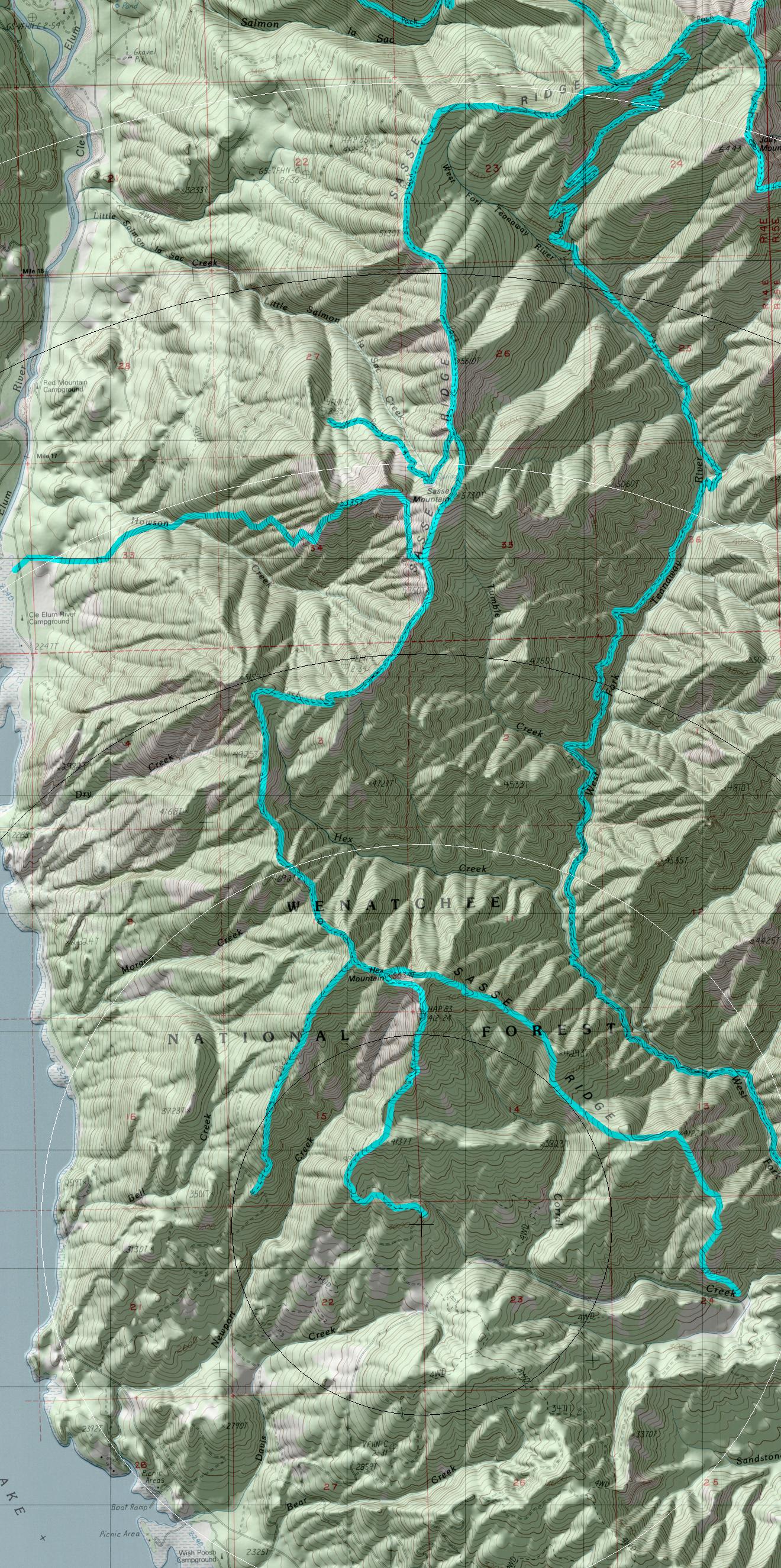
click on map to zoom in for trail location
|
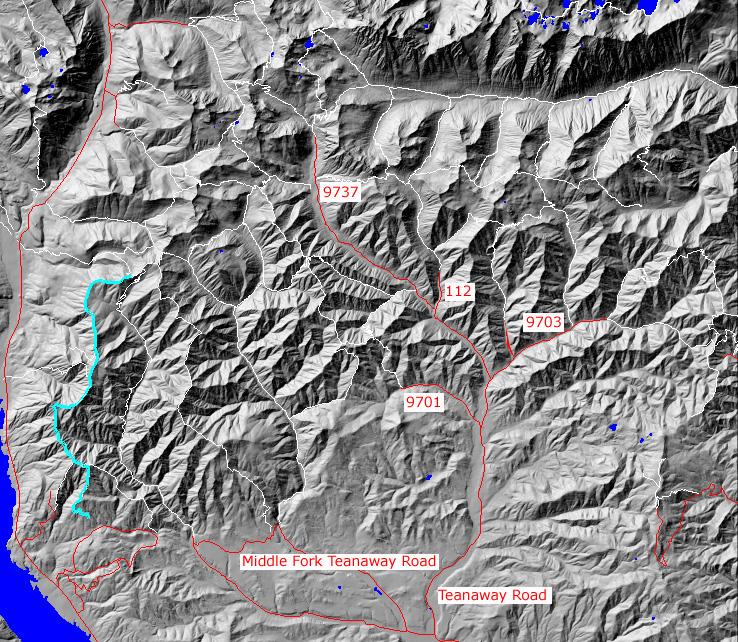
TRAILHEAD ACCESS: From I-90 Exit 80, head north through Roslyn, north on Highway 903 to Lake Cle Elum, north along lake to FS Road 4305, east on 4305 to FS Road 4305-118, then north on 118 to trailhead
PARKIING AND FACILITIES: There is a small parking lot, with room for 6 vehicles. The are not facilities at the trailhead.
TRAIL: From the south, the trail begins in a 1960s pine plantation, begins climbing steadily to the top of Hex Mountain. this portion of the trail is wide and copped ip in many places from logging roads. From Hex Mountain the trail follows the ridgetop, climbing and descending many times, ending at the junction with Jolly Mountain Trail #1307. This trail is rugged due to the fact that it is an old sheep driveway and has not been updated. The portion of trail from Hex Mountain Trail #1343 to Little Salmon La Sac trail #1325 is closed to motorized use.
SETTING: Logging activities, ridge and mountain tops, old-growth trees, subapline zone, open rocky and grassy hilsides.
OPPORTUNITIES: Hiking, horseback riding, mountain biking, motorcycle riding, scenery, wildlife, hunting photography.
OTHER TRAILS:
Gregg Petrie ©2000
return to Cle Elum Home Page