
| Teanaway Basin Home | Contact Infomation | Statistics Explained | Map Information | Scope |
|---|
STATISTICS:
|
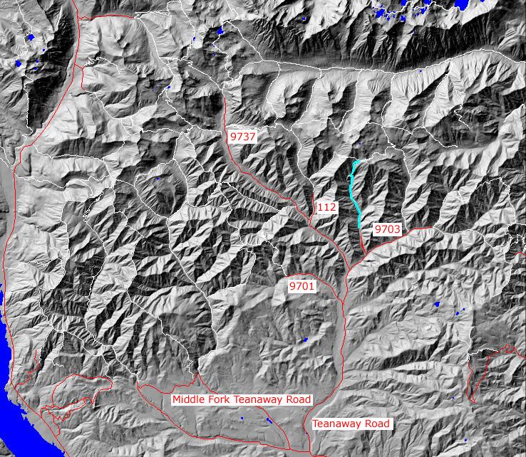
click on map to zoom in for trail location
|

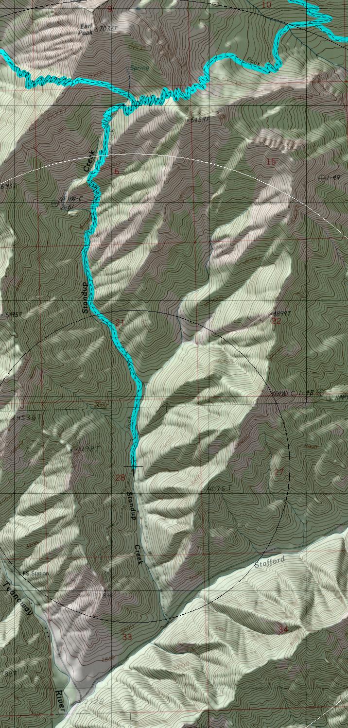
(profile to trail junction)
TRAILHEAD ACCESS: From I-90 Exit 86, go north on Highway 970,then
north on Teanaway Road to the end of the country road at 29 Pines
campground. Form there, head north on FS Road 9737, northeast on FS
Road 9701, then north on 9703-112 to the trailhead alongside
Standup Creek
PARKING AND FACILITIES: The is parking for 6+ vehicles, but no other facilities
TRAIL: For the first mile the trail follows an old loggin road that is now indistinct. It then begins to climb steeply with many switchbacks, over a divide at 6200 feet, and then drop to the Stafford Creek trail #1359. The trail is in fair condition with little erosion. There are a few minor creek crossings, and a spring is close to the trail near the top of the divide.
SETTING: Valley bottom, stream, old-growth tress, old logging, ridgetops, open hillsides, meadows, riparian zone, subapline zone
OPPORTUNITIES: Hiking, horseback riding, scenery, wildlife, wildflowers, camping.
OTHER TRAILS:
Bean Creek #1391.1,
Stafford Creek #1359
return to Home Page
Gregg Petrie ©2000
