| Teanaway Basin Home | Contact Infomation | Statistics Explained | Map Information | Scope |
|---|
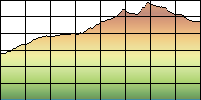
STATISTICS:
|
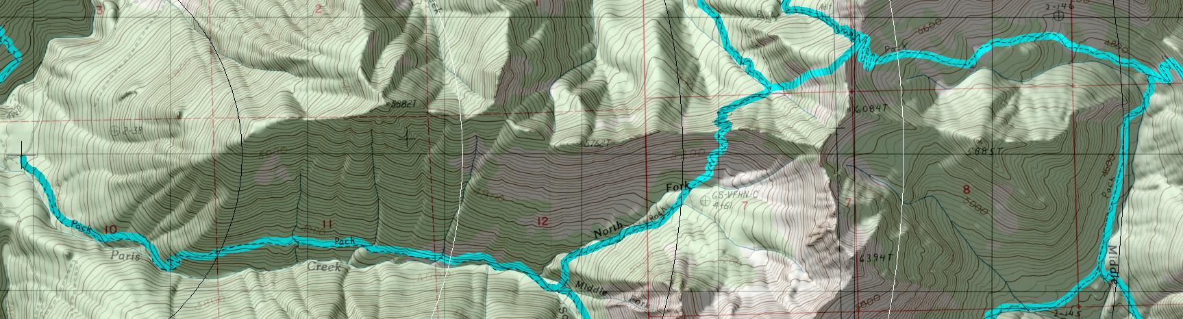
click on map to zoom in for trail location
|
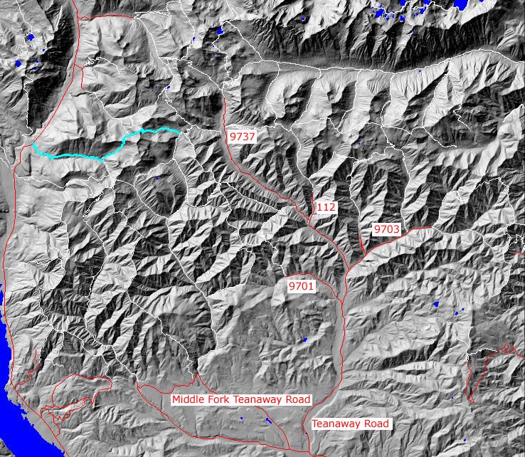
TRAILHEAD ACCESS: Take Highway 903 from Cle Elum or Roslyn north to lake Cle Elum. Go north along the lake to the end of the county orad at Salmon Ls Sac and continue north FS Road 4330 about 2 miles to the Trailhead. This tralhead is combined with Davis Peak Trail #1324
PARKING AND FACILITIES: Parking for 10 vechicles, no other facilities.
TRAIL: This trail climbs steadily, staying on the north side of Paris Creek. It levels off on a bench after 1.5 miles and is in a clearcut (199) for the next mile. After reaching the junction with Jolly Mt. Spur #1307.1, it turn northeast(left) and climbs steeply out of the Paris Creek Basin. It then descends into the South Fork Boulder Creek and climbs again, this time to its end at the ridgetop and junction with Middle Fork Teanaway Trail #1393. While much of this trail is in good condition, portions are steep and narrow.
SETTING: Stream, old-growth trees, large clear-cut, subalpine zone, meadows, mountains, ridgetops.
OPPORTUNITIES: Hiking, horseback riding, wildlife, scenery, camping, unting.
OTHER TRAILS: Davis Peak #1324,
Jolly Mountain Spur #1307.1,
South Fork Boulder Creek #1392.7,
Middle Fork Teanaway #1393
return to Home Page
Gregg Petrie ©2000