| Teanaway Basin Home | Contact Infomation | Statistics Explained | Map Information | Scope |
|---|
STATISTICS:
|
click on map to zoom in for trail location
|

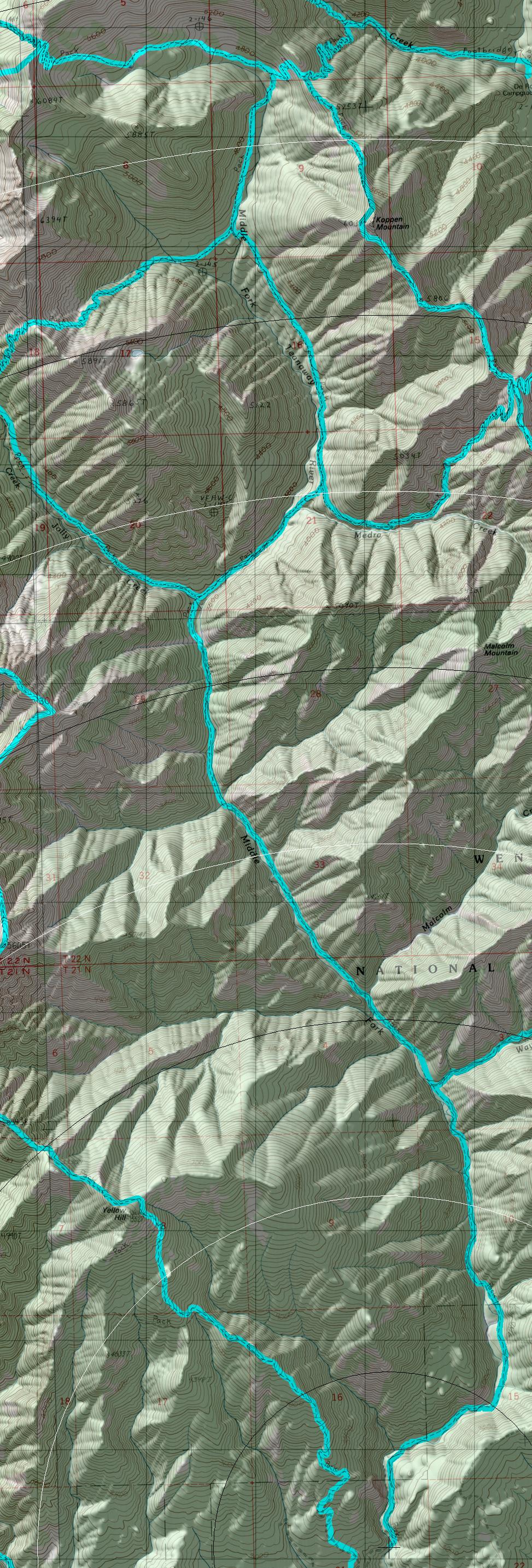
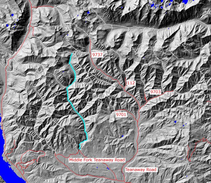
TRAILHEAD ACCESS: From Highway 970 about 6 miles east of Cle Elum turn north onto the Teanaway Road and follow it to an intersection just past the first bridge crossing the Teanaway River. take a left and follow the road to the next intersection, then turn right onto the Middle Fork Teanaway Road. Follow it about 5 miles (pavement gives way to gravel) to where the road crosses a bridge over the Middle Fork. The trailhead is just past the bridge.
PARKING AND FACILITIES: Roadside parking is available, There are no other facilities.
TRAIL: For most of its 12 miles, this trail has fairly moderate grade, but there are approximately 17 river crossings that can make travel difficult, particularly during high water. From the trailhead and river crossing #1, the trail follows and old road up the valley though meadows and groups of trees. It crosses the river several times and due to seasonal shits in the river course, may be hard to locate. At approximately 4 miles to a junction with Way Creek trail #1235, the valley narrows, and the trail enters thick fir and pine forest. It continues on another 4 miles to a junction with Jolly Creek trail #1355. Beyond Jolly Creek, the trail steepens and continues up the valley past Johnson Medra trail #1383; at times it is some distance above the river. At about the 10-mile point, the trail reaches the old Skookum Mine site (the old road bed, which appears intermittently up to this point, ends). Beyond the Skookum Mine, the trail passes thought some meadows and soon hits the junction with DeRoux Spur trail #1392.1, beyond which it takes a left and heads up into a meadowy basin and ends on the scenic ridgetop between Boulder creek and the Middle Fork.
SETTING: River and creek valley, meadow, forest, ridgetop
OPPORTUNITIES: Hiking, horseback riding, motorcycle riding, mountain biking, scenery viewing, photography, wildflower, fishing, hunting, camping
OTHER TRAILS:
Way Creek #1235,
Jolly Creek #1355,
Johnson Medra #1383
Skookum Basin #1393.1,
DeRoux Spur #1392.1
return to Home Page
Gregg Petrie ©2000