
| Rainier Home | Contact Infomation | Statistics Explained | Map Information | Scope | Current Conditions |
|---|
STATISTICS:
|
click to expand map icon

|
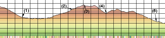
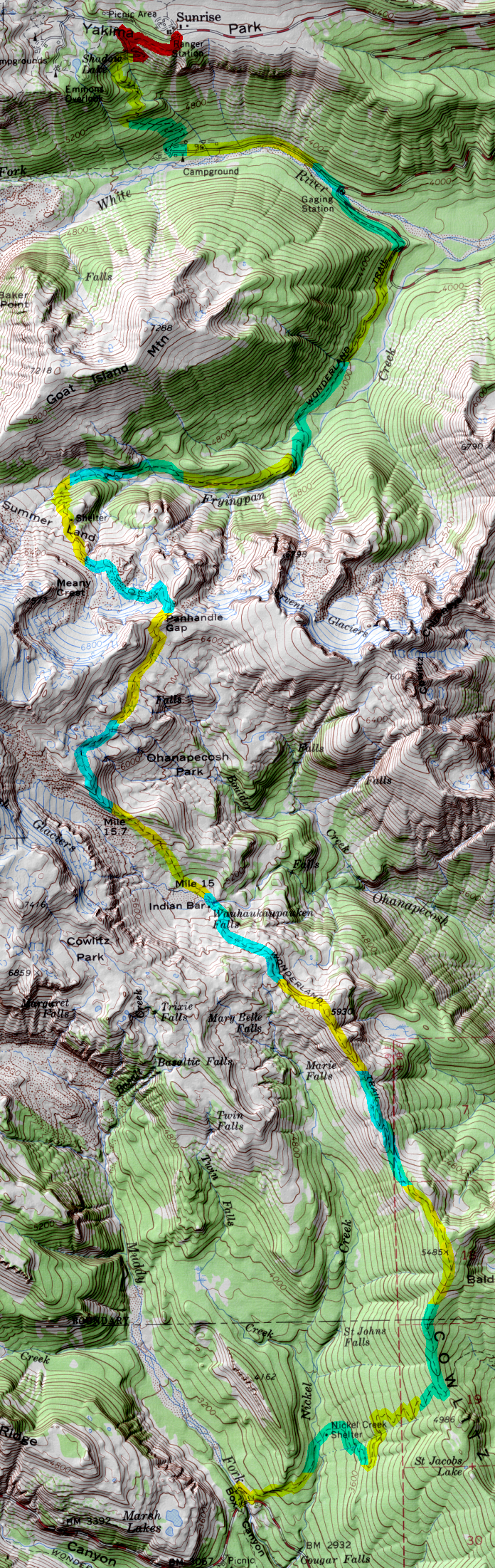
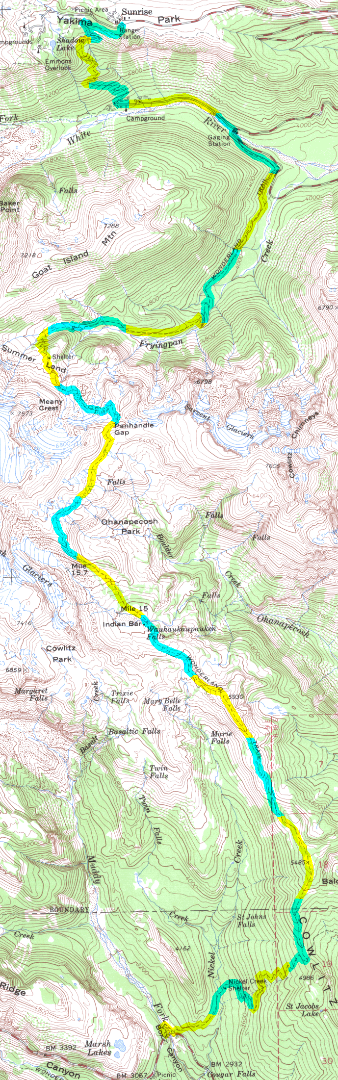
- (1) White River Campground
- (2) Summer Land shelter
- (3) Panhandle gap
- (4) Indian Bar Shelter
- (5) Nickel Creek Shelter
For a detailed description the reader is referred to "Discovering the Wonders of the Wonderland Trail: Encircling Mount Rainier" by Bette Filley
| Map Discription | Size (kb) |
| Small colored elevaton map | 39 |
| Topographic map with shadeing | 2,468 |
| Topographic map without shadeing | 905 |
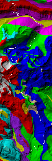
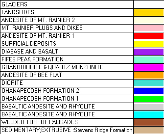
| Shaded Basement Geologic Map | 168 |
|
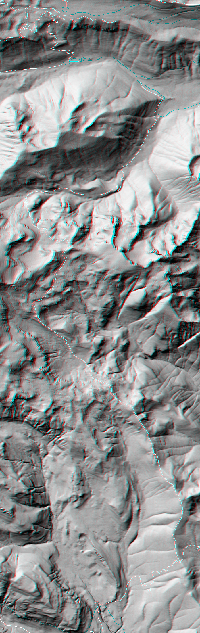
Stereo Map To see this image you will need special glasses (which I will provide if you contact me before supplies run out) |
1,756 |
return to main Rainier Trail Index
Gregg Petrie ©2000