
| Teanaway Basin Home | Contact Infomation | Statistics Explained | Map Information | Scope |
|---|
STATISTICS:
|
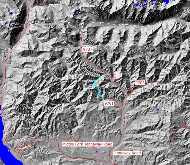
click on map to zoom in for trail location
|
TRAILHEAD ACCESS: From I-90 Exit 85, go north on Highway 97 to Teanaway Road, then north on Teanaway Road, north on the North Fork Teanaway Road and northwest on FS Road 9701 to the trailhead
PARKING AND FACILITIES: There is roadside parking for 6 vehicles.
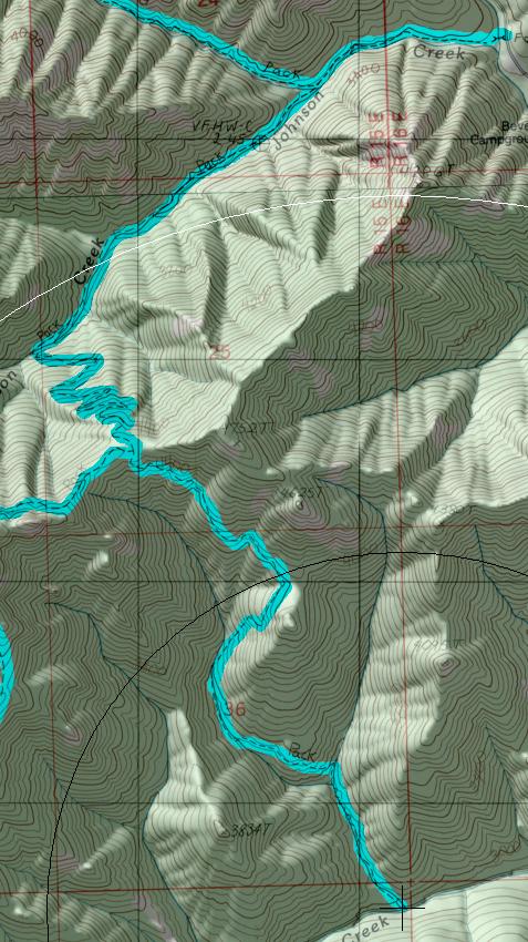
TRAIL: It follows and intermittent stream for 1 mile then climbs steadily, with several switchbacks, to the divide between Jungle Creek and Johnson Creek. It then descends along the South Fork of Johnson Creek to its end at the junction with Johnson-Medra Trail #1383 .
SETTING: Stream open hillsides, ridgetop, stands of moderate sized trees
OPPORTUNITIES: Hiking, horseback riding, motorcycling, scenery, hunting.
OTHER TRAILS:
Way Creek #1235,
Johnson-Medra Trail #1383
Gregg Petrie ©2000