| Teanaway Basin Home | Contact Infomation | Statistics Explained | Map Information | Scope |
|---|
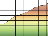
STATISTICS:
|
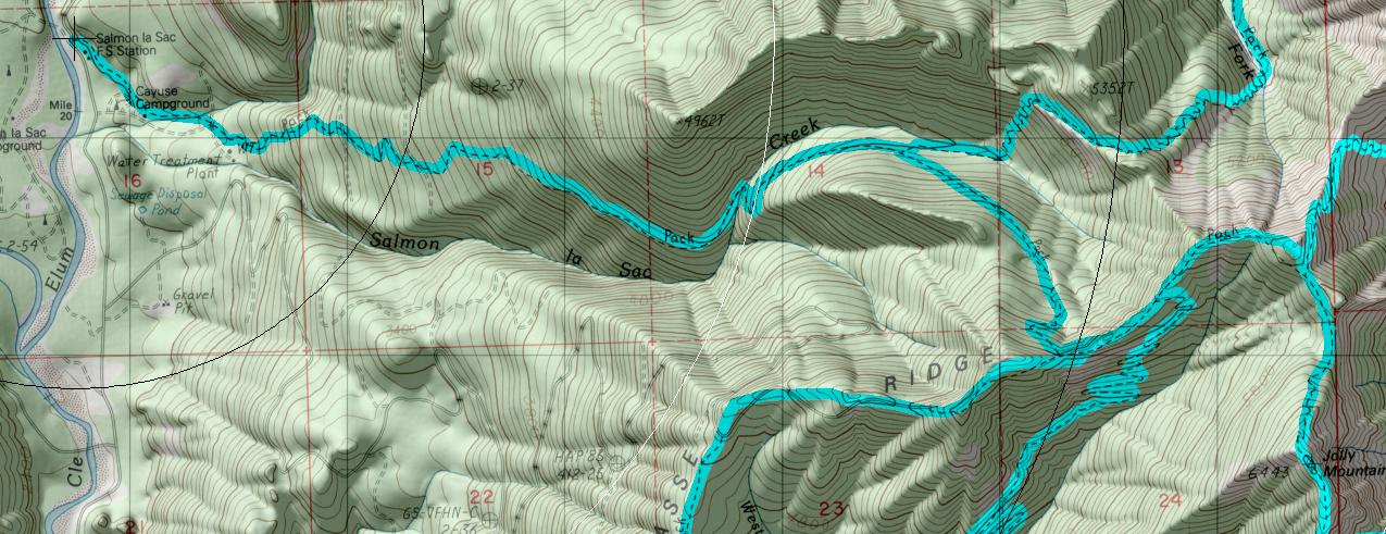
click on map to zoom in for trail location
|
TRAILHEAD ACCESS: From Roslyn take Highway 904 to Lake Cle Elum, then county road to Cayuse Campground, which is to the right just before the Salmon La Sac Guard Station, Trailhead is at the back end of the campground
PARKING AND FACILITIES: There is parking for 10+ vehicles, unloading ramp for stock, toilets, running water, and camp sites (Fee Camping)
TRIAL: Climbs steadily though clearcuts with numerous switchbacks, crossing Salmon La Sac Creek at about 3 miles, At the junction with Sasses Ridge Trail #1340, trail turns left and follows the ridge top, until the finial ascent of Jolly Mountain, which includes a number of switchbacks. This is a fair trail, bit it does climb very steadily. For most of the summer, Salmon La Sac Creek us the only water, early in the season there will be snow banks on Jolly Mountain.
SETTING: Stands of old-growth timber, clearcuts, ridgetops, meadows, mountaintop, subalpine zone.
OPPORTUNITIES: Hiking, horseback riding, motorcycle riding, wildlife, scenery, hunting.
OTHER TRAILS: From bottom to top: Jolly Mountain Spur #1307.1
which joins to
Paris Creek #1393.1,
Sasse Ridge #1340,
Jolly Creek #1355,
Yellow Hill #1222
Gregg Petrie ©2000