| Teanaway Basin Home | Contact Infomation | Statistics Explained | Map Information | Scope |
|---|
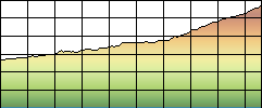
STATISTICS:
|
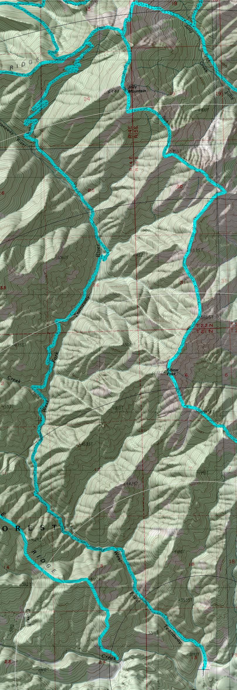
click on map to zoom in for trail location
|
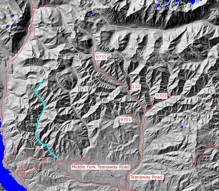
TRAILHEAD ACCESS: To the south(low) end: take I-90 Exit 86, go northeast on Highway 970 to Teanaway Road, north on Teanaway Road, west on the West Fork Teanaway Road, North on the Middle Fort Teanaway Road to the end of the county road, north and west on FS Road 4305-113 to the railhead along the West Fork Teanaway River. the last 5 miles of this road is winding, rough, slippery when wet, and may be gated in a portion of the year on private land
PARKING AND FACILITIES: Adequate parking for 10+ vehicles.
TRAIL: Parallels the river with several crossings. In places the trails climbs high above the river to avoid cliffs and other obstructions in this deep, rugged canyon. The upper end of the trail is a series of switchbacks as it climbs to meet Jolly Mountain Trail. Most of the rail is quite narrow but has a gradual grade.
SETTING: Stream, riparian zone, canyon, large old-growth trees, cliffs, open rocky hillsides, ridgetop.
OPPORTUNITIES: Hiking horseback riding, mountain biking, motorcycle riding, ]fishing, scenery, wildlife, hunting, camping.
OTHER TRAILS:
Jolly Mountain #1307,
Yellow Hill#1222,
Sasse Ridge #1340
return to Home Page
Gregg Petrie ©2000